Flood Risk
EO Capability Benefits
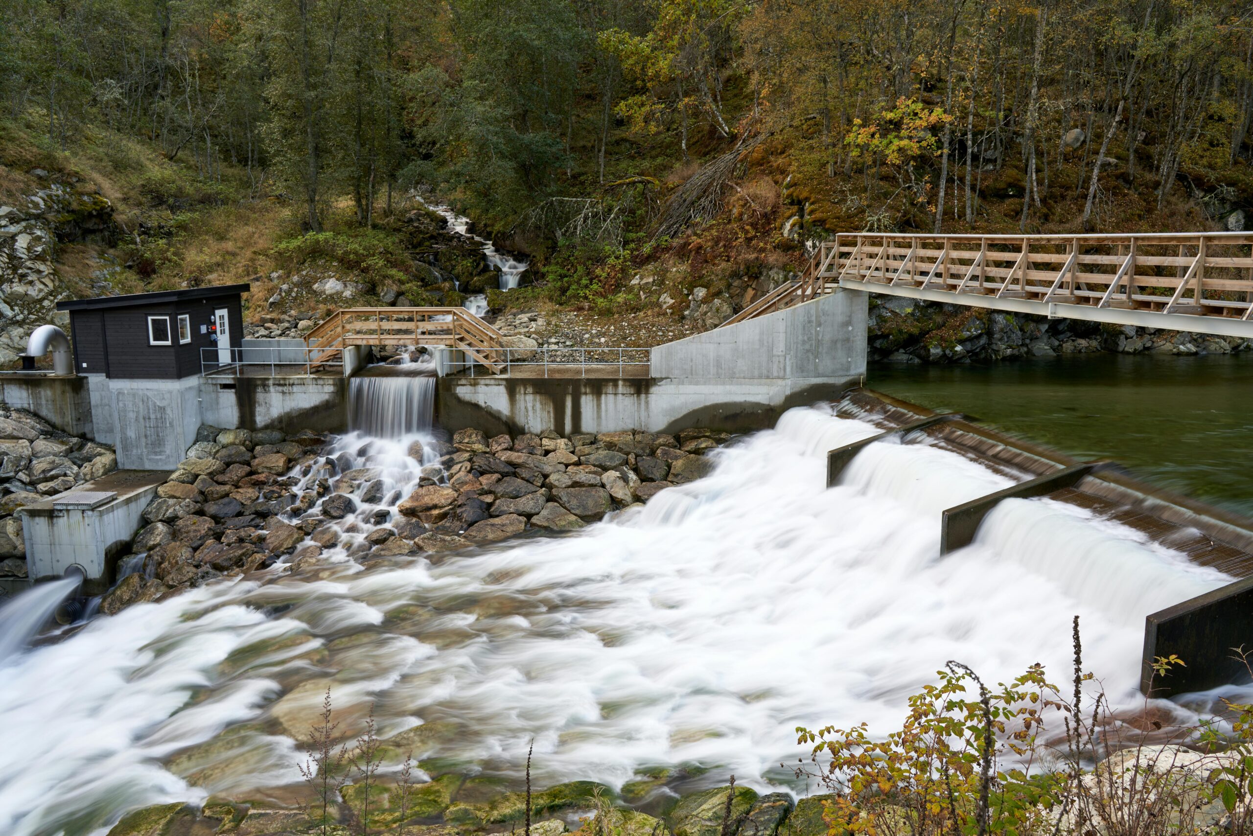
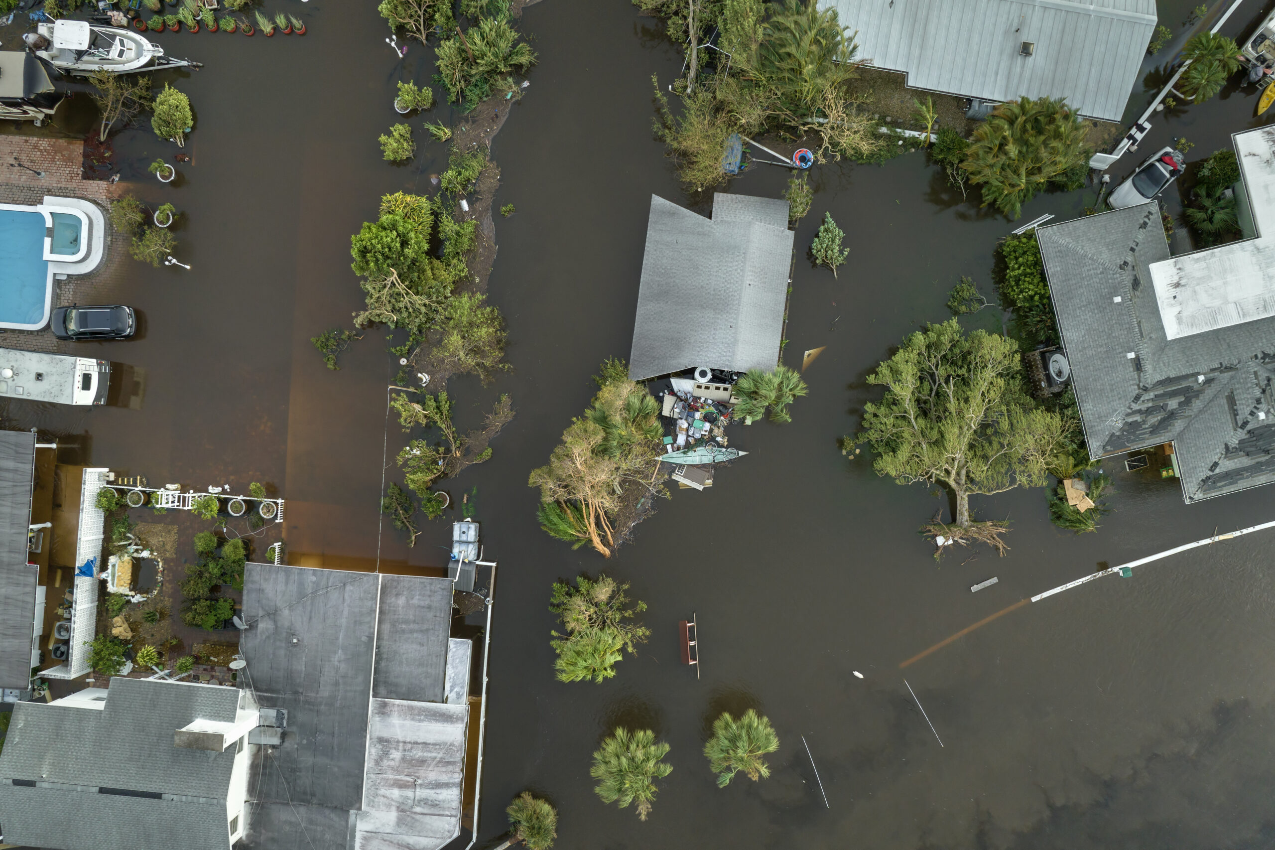
Floods impact communities worldwide, resulting in loss of life, damaged infrastructure and natural assets, and threatened livelihoods. As climate change increases extreme weather events, and with the increased urbanization in flood‐prone areas , flood‐related losses will continue to worsen, increasing the urgency for effective tools to monitor recovery. Many Earth Observation applications exist for flood event mapping, providing insights on location, timing, and extent in near real‐time. EO data can also monitor long-term historical records of floods enabling more accurate flood-risk assessment and forecasting , ultimately supporting better preparedness and recovery efforts.
EO Capability Description
Floods are among the most frequent natural disasters, and their occurrence is increasing due to climate change. Agricultural intensification, urbanisation, and soil sealing reduce natural drainage capacity and heighten the risk of flooding. Risk arises from a combination of three determinants: hazard, exposure and vulnerability. A hazard such as a flood is usually characterised in terms of its probability and intensity at a given location. Exposure refers to the people and assets located in areas where hazards can occur. Vulnerability indicates how severely exposed people or assets will be affected when a hazard occurs, and how quickly they can recover. Earth Observation (EO) data primarily contributes to assessing the hazard and exposure components. The vulnerability component is often limited to socio-economic indicators, though EO can provide additional information (e.g. on building typologies).
A scale of increasingly complex and data-expensive methodologies may be outlined as follows:
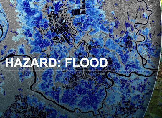
- Semi-Quantitative, GIS-based Multi-Criterion Analysis. This approach assigns weights to normalised input rasters through Analytical Process Hierarchy (AHP) or equivalent methods. Only coarse terrain information derived from medium- to high-resolution Digital Elevation Models (SRTM, ASTER) is used, along with freely available exposure rasters (e.g. Land Use Land Cover, gridded population density). Medium- to high-resolution free and open optical imagery can be used to derive flood extent through the Normalized Difference Water Index (NDWI). A final risk score is produced through simple raster algebra. This approach has limitations: flood depth and velocity are not considered, and the weighting step introduces significant uncertainty. Moreover, cloud cover presence will limit optical image acquisition during flood events.
- SAR-based Flood Extent and Very High Resolution (VHR)-based Vector Data. This approach uses SAR imagery (e.g. from Sentinel-1) to outline the inundation extent by comparing pre-flood and flood-event acquisitions, as smooth water surfaces exhibit minimal backscatter on radar imagery. Optical imagery (e.g. from Sentinel-2) can be used for validation. It is possible to optimise exposure inputs through open vector data of building footprints and infrastructure networks. VHR optical imagery can supplement vulnerability assessments by differentiating building typologies. However, neither flood depth nor velocity are considered, and SAR acquisitions may miss the peak flood extent. Additionally, vegetation may obscure water, while double bounce scattering between buildings represents a challenge in urban contexts.
- Coarse Resolution Hydrodynamic Modelling. EO data is used for model calibration and validation, adjusting model parameters to improve the fit between simulations and observations: SAR- or /optical imagery- derived flood extent, radar altimetry-derived water levels, passive microwave imagery- derived inundation information, and in-situ stage/flow data. Once fully calibrated, these models may also be run to both nowcast and forecast flood events. While hydrological models simulate parts of the hydrological cycle, hydraulic models describe the flow of fluids, providing estimates of water depth, flow velocity and water extent. While free and open DEMs such as SRTM can be used in these instances, both data requirements and computational costs are higher in comparison to the abovementioned approaches.
- Fine Resolution Hydrodynamic Modelling. Ever-higher-resolution DEMs are available, bearing in mind that computational demands will increase alongside accuracy in flow path, flood depth and inundation prediction (which are particularly critical for infrastructure planning). Merged DEMs (i.e. very high resolution for river channels and medium resolution, e.g. 30m, for the surrounding areas) can be a cost-effective compromise. VHR-derived building footprints and heights further supplement the fidelity of the flood model, while building material classification from VHR texture analysis, in combination with damage functions specific to structure types (e.g. wood, masonry, concrete), can enhance vulnerability assessments.
These methods can be integrated into early warning systems, such as the Copernicus Emergency Management Service’s Global Flood Awareness System (GloFAS), to enhance disaster preparedness and support long-term flood management. By combining near real-time satellite data with ground-based measurements, these systems generate inflow forecasts for selected rivers or reservoirs, providing timely and actionable information for risk mitigation.