Flood Extent
EO Capability Benefits
Flood extent maps are useful both during and immediately after a flood event, allowing emergency response to be more efficiently deployed. Knowing the extent of past flood events can also inform land use planning decisions, guide infrastructure development, and support the design of flood prevention measures. They can be more effective at sensitizing the public about flood risk than predictive models, although past flood events are increasingly less reliable predictors of future flood events due to the effects of climate change. Finally, flood extent maps are used to validate predictive flood risk models.
EO Capability Description
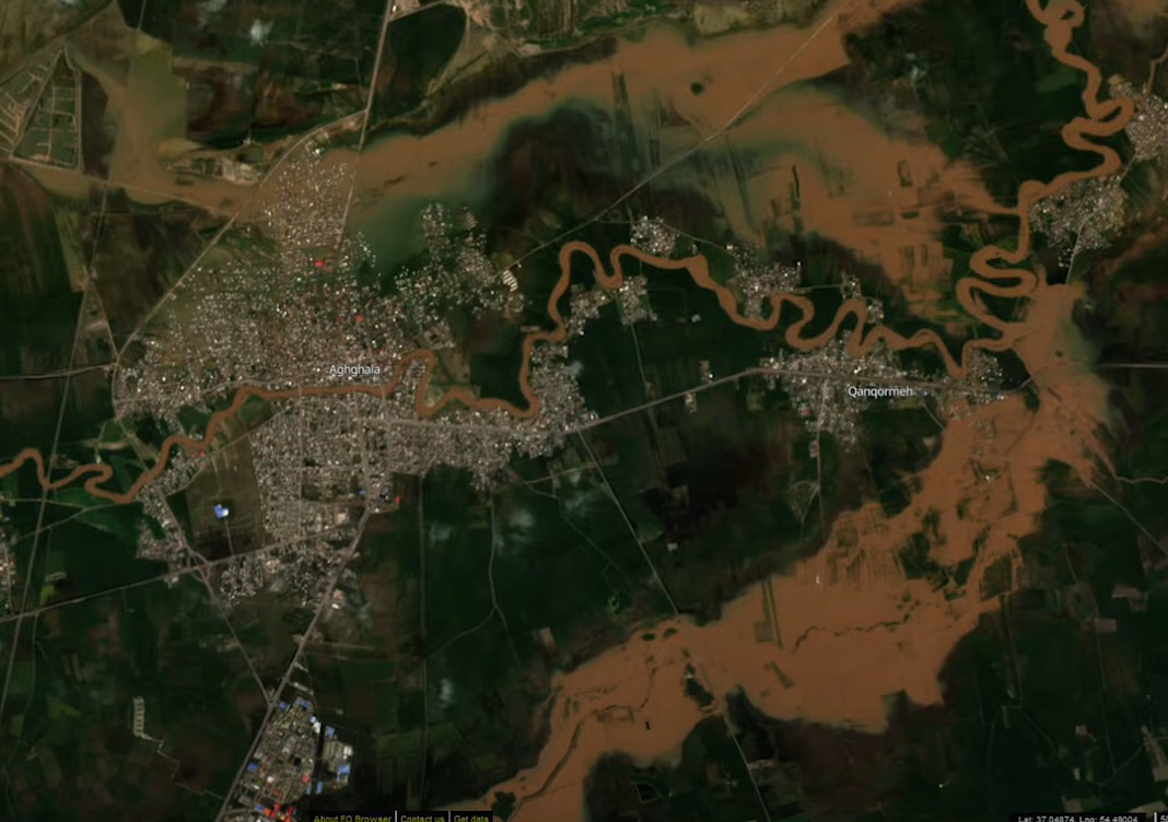
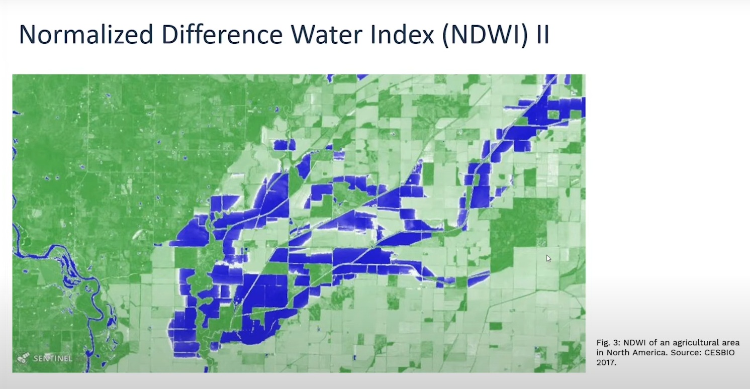
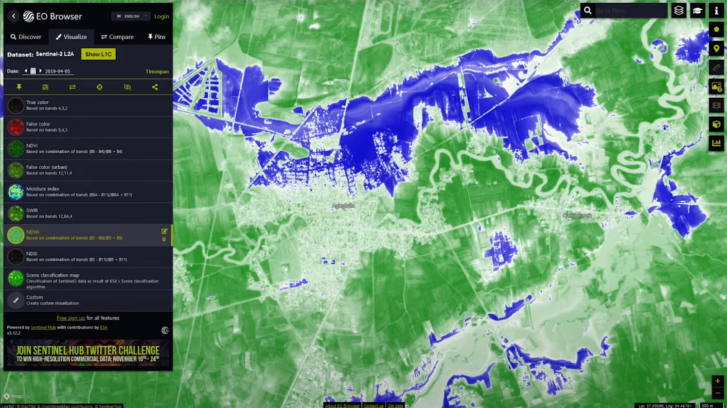
Optical sensors like Sentinel-2 and Landsat can identify areas submerged by water due to water’s unique spectral signature. However, cloud cover can impact their effectiveness. Synthetic Aperture Radar (SAR) sensors such as Sentinel-1 can penetrate clouds and detect flooded areas even in poor weather conditions, making them a valuable alternative. Flooded areas are usually differentiated from the normal, non-flooding extent of surface water bodies such as rivers or lakes. It should be noted that the relatively low temporal resolution (i.e. the frequency of satellite overpasses) of SAR satellites can represent a challenge when dealing with rapidly evolving flood events, particularly flash floods. Sentinel-1 has a revisit time of 6 days at the Equator and more frequent coverage at higher latitudes. TerraSAR-X has a revisit time of 11 days.
When used in combination with Digital Elevation Models (DEMs), flood extent enables the estimation of flood depth. Additionally, overlaying flood extent maps with Land Use/Land Cover, Building Footprints, and Population Density data can provide valuable insights for assessing the socio-economic impact of a particular flood event. Similarly, overlaying flood extent with a transport network can identify roads that are unavailable for emergency response or evacuation routes.