EO Capability Benefits
Earth Observation (EO) technologies enable effective landslide management through landslide inventories, susceptibility assessments, and near real-time monitoring. They facilitate rapid detection of unstable areas, monitor the temporal evolution of landslides, and contribute to emergency management. Following a landslide, EO data helps delineate and monitor affected areas, supporting effective recovery and future risk management.
EO Capability Description
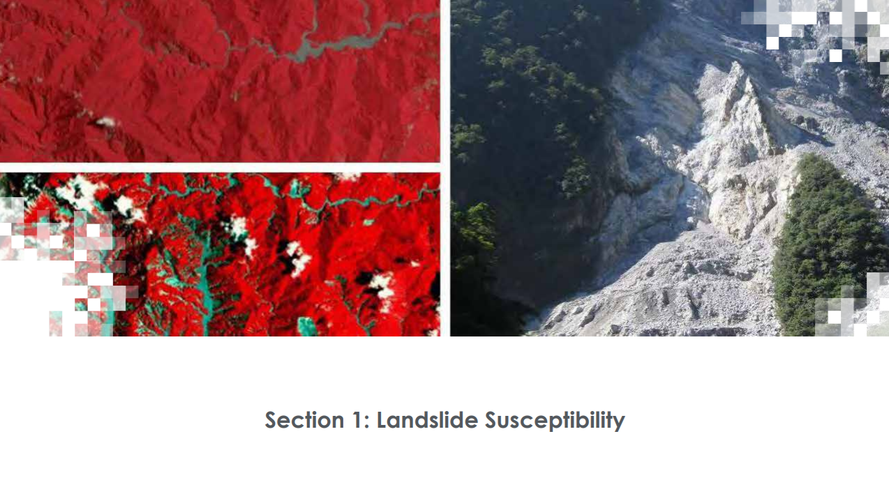
Landslides are downslope movements of rock, soil, or debris triggered by geophysical or hydro-meteorological events like extreme or prolonged rainfall, earthquakes, volcanic eruptions, rapid snowmelt, and anthropogenic actions such as slope undercutting or construction. Landslides are frequent natural hazards which occur globally, causing significant disruptions, damage, and casualties, particularly in hilly areas where vulnerability is high and preparedness is more challenging.
The landscape of landslide susceptibility analysis is expansive and complex. A scale of increasingly accurate (and data-expensive) landslide susceptibility methodologies may be outlined as follows:
- Digital Elevation Model-only. These probabilistic morphometric analyses seek to overcome the dominant constraints of data-driven approaches (i.e. the lack of inventories of past landslides and inconsistent covariate data) by assuming that hillslopes with higher relief and gradient are more prone to landslides compared to the surrounding landscape. A DEM-only approach can offer a defensible “baseline susceptibility” for shallow landslides, especially for stakeholders needing to screen large corridors across multiple countries.
- Heuristic overlay. These approaches derive susceptibility from expert judgement about which factors (e.g. slope, geology, and vegetation) influence slope failure, and to what extent. Weights can be assigned based on various methods, including single expert judgement, rule-based scoring (if-then), fuzzy logic, or the Analytic Hierarchy Process (AHP). The advantage of this approach is its deployability in data-scarce environments, though caution is necessary due to inherent biases and limited reproducibility.
- Bivariate and Multivariate Statistics-based approaches. A landslide inventory (presence, sometimes absence) is related to environmental covariates (e.g. slope, curvature, land cover) through statistical models, either bivariate (factor-by-factor) or multivariate. The quality of these approaches can vary significantly and it is determined, among other factors, by the completeness and representativeness of the inventory, the spatial and temporal validation design, and the degree to which model uncertainty is reported.
- Machine learning/AI-driven models. ML/AI-based models (e.g. Random Forest, Support Vector Machines, neural networks) learn complex interactions between covariates and landslide occurrences. Over time, an increasing preference for these approaches has been observed. A central constraint, however, is limited transferability when inventories are incomplete or not representative.
- Physically based/deterministic slope stability modelling. These approaches adopt mechanistic models that attempt to describe the balance between driving and resisting forces. Applicability is geared towards engineering-scale decisions to protect high-consequence assets. Models are the most data-expensive, requiring field campaigns, geophysics, or high-resolution terrain/material mapping, otherwise requiring assumptions about the uniform or zonal properties of soil and geotechnical properties.
Complete and representative inventories are crucial for landslide susceptibility mapping. For inventories, optical imagery can be interpreted visually or through automatic/semi-automatic algorithms; however, this approach is affected by cloud cover and only operates in daylight conditions. By contrast, the all-weather, day-and-night capabilities of Synthetic Aperture Radar (SAR) have led to growing interest in the use of this technology for landslide detection, notwithstanding inherent challenges, such as layover and shadowing in steep terrain.
Beyond pure susceptibility, decision-makers often require early warning capabilities that combine susceptibility mapping with nowcasting/forecasting of potential triggers, such as rainfall or soil moisture, to produce a probabilistic hazard output as part of an operational system.