EO Capability Benefits
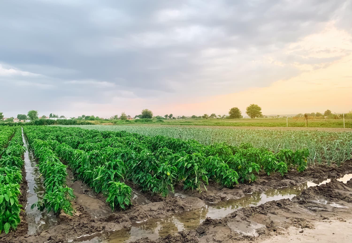
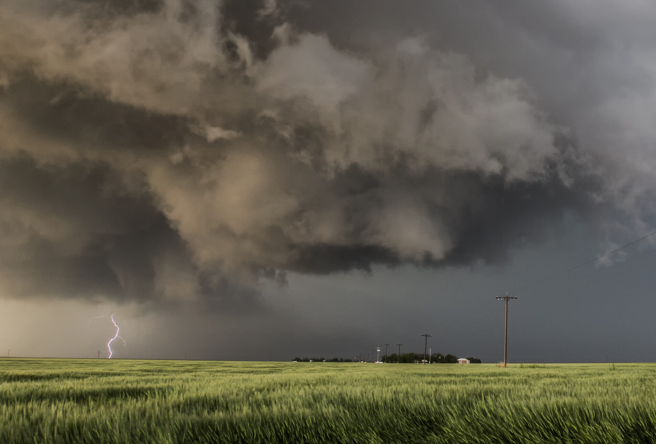
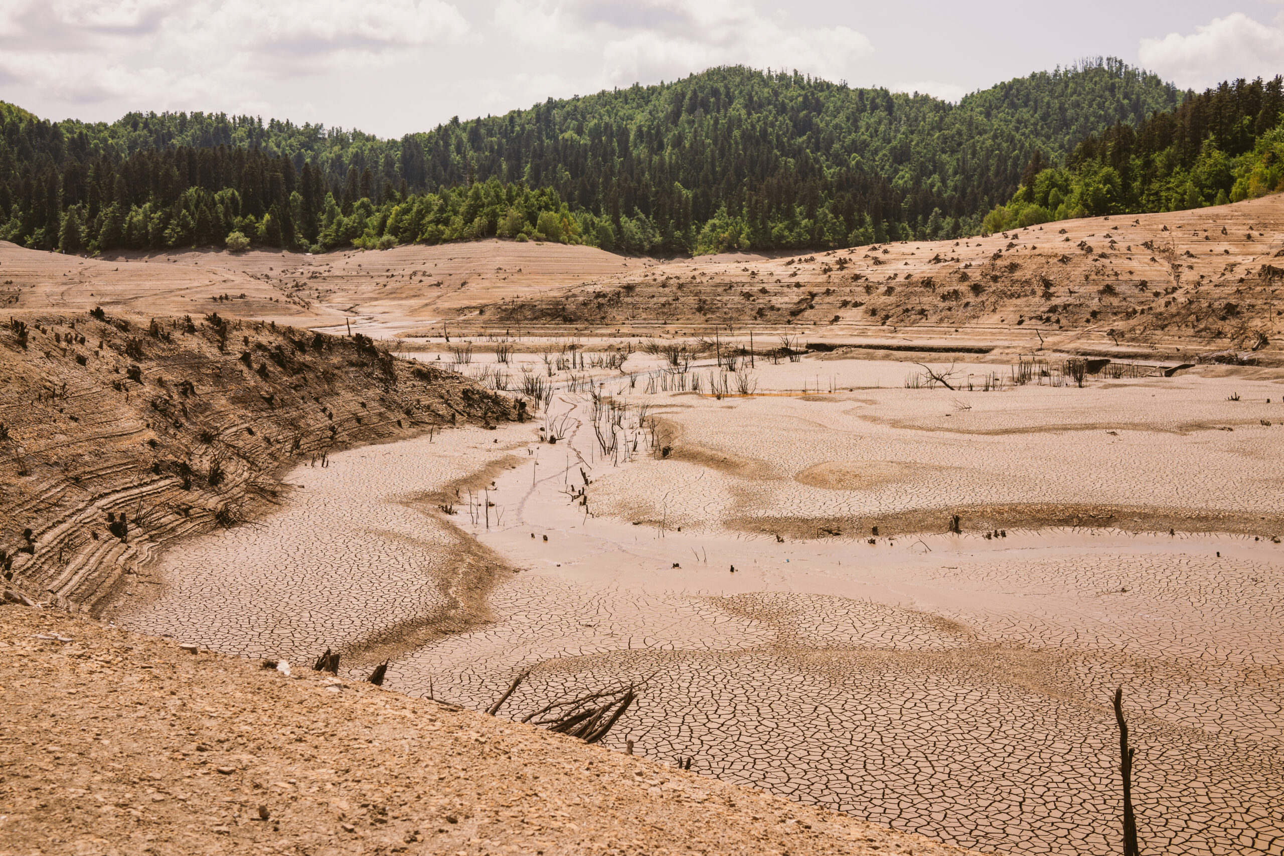
Earth-Observation (EO) precipitation data provides essential for a wide range of applications including resource planning, disaster risk management, climate impact studies, hydrological modelling, and agriculture. In the context of agriculture, EO-driven precipitation estimates support irrigation management, crop planning, and yield forecasting, thereby contributing to more robust food security strategies. In relation to climate change, long-term EO-based precipitation records are essential for identifying trends, detecting anomalies, and generating reliable evidence-based climate adaptation and mitigation strategies. EO-based precipitation estimates help overcome the spatial and infrastructure-dependent limitations attached to traditional ground-based methods (e.g rain gauges, weather radar, meteorological stations) and allow to generate frequent rainfall insights in data-scarce and remote locations. By facilitating near-real-time observations over multiple scales and with high consistency, early warning systems and preparedness measures can be significantly optimised. The ability to track shifts in rainfall patterns, intensity and seasonality over time and space allows for a better understanding of the water cycle and supports resource planning, as well as resilience and response to climate-related hazards (e.g floods and droughts).
EO Capability Description
Precipitation (rain and snow) is a fundamental component of the global hydrological and energy cycle, helping to regulate the climate system. Satellite remote sensing data has been used since its early days for precipitation estimation at regional to global scales, with particular value in isolated and data-scarce areas with limited ground-observation networks.
From the satellite perspective, precipitation monitoring is mainly reliant on microwave sensors, such as those onboard the Global Precipitation Measurement (GPM) mission, to measure the amount, intensity and distribution of rainfall and snowfall over land and oceans. Passive microwave sensors detect natural microwave emissions from the atmosphere and Earth’s surface, which can be converted into quantitative rainfall and snowfall estimations.
Active microwave sensors, such as radar, measure the backscatter signal from raindrops or snowflakes, enabling structure measurements of precipitation. Infrared sensors commonly found on geostationary satellites like GOES or Meteosat, on the other hand, measure temperature on cloud tops, which can be linked with the intensity of precipitation.
Most satellite rainfall products combine inputs from multiple sensors (visible, infrared, passive microwave and radar) and in situ measurements from rain gauges and weather radar, increasing the accuracy and reliability of generated precipitation products. This fusion also helps to overcome the limitations of individual platforms and sensors, and supports accounting for different types of precipitation and spatiotemporal variability.
Indicative Cost Range Details
As use cases involving climate and weather data often require frequently updated or even ‘real-time’ observations rather than a once-off mapping exercise, pricing tends to follow a subscription model. License fees then often differentiate between various user groups. An example would be the European Centre for Medium-Range Weather Forecasts’ data pricing models. Free and open precipitation data can be obtained, for instance, at 0.1 degrees and lower spatial resolutions from the Global Precipitation Measurement (GPM) mission.