Nighttime Lights
EO Capability Benefits
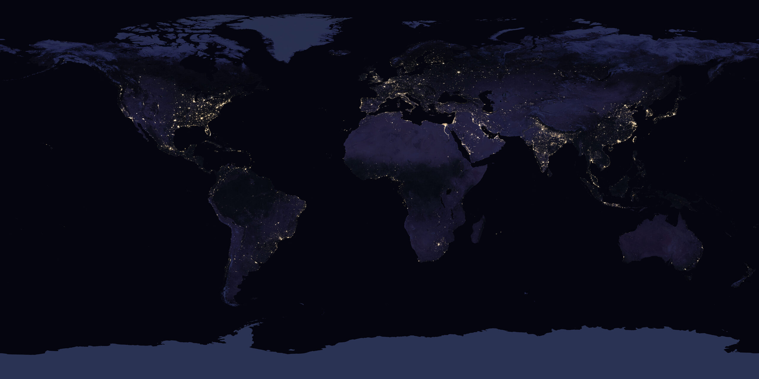
Nighttime Light (NTL) data reveal where people live, work and move, because artificial lighting is closely linked to human presence and infrastructure. This makes NTL useful for mapping urban expansion, informal settlements, economic activity, wealth and electrification, even where conventional statistics are missing or outdated. NTL data is also central to quantifying light pollution and its ecological and health impacts. The data are collected consistently over large areas, enabling cross‑country comparison and long‑term tracking of development trends. A dimming in nighttime lights may indicate reduced light pollution resulting from an increased use of energy-efficient LEDs and successful energy conservation efforts, or an energy crisis caused by power shortages. Moreover, they are an increasingly important data source for monitoring multiple Sustainable Development Goals (SDGs).
EO Capability Description
NTL data are detected by very sensitive optical radiometers onboard polar‑orbiting satellites that measure extremely faint visible/near‑infrared radiance emitted by artificial light sources (e.g. streetlights, buildings, vehicles, fishing vessels) or reflected moonlight, then convert those measurements into calibrated brightness values on a global grid. The main sensors are broad‑band, low‑light imaging radiometers such as the earlier Operational Linescan System (OLS) onboard the Defense Meteorological Satellite Program (DMSP) satellites and the later workhorse of NTL imaging, the Visible Infrared Imaging Radiometer Suite (VIIRS) with its Day/Night Band (DNB) onboard multiple agency satellites, including the upcoming NOAA/NASA/EUMETSAT Joint Polar Satellite System (JPSS). In principle, other multispectral imagers (e.g. MODIS, Sentinel‑2, Landsat) have visible bands that can detect bright lights at night; however, they are not designed for ultra‑low‑light sensitivity the way VIIRS‑DNB was, and therefore are not routinely used to generate global NTL products.
While VIIRS offers better radiometric sensitivity compared to OLS, which improved dim lights detection and reduced saturation in bright urban cores, it struggles to detect blue‑rich LED light, it is susceptible to clouds and moonlight effects, and it still has a relatively low spatial resolution of 750m natively. This means that small settlements, individual roads or isolated light sources may be blurred or diluted, especially at off‑nadir viewing angles.
Finally, it should be noted that composite NTL products often mask or filter transient light sources such as gas flares, fires or boats. This is necessary when the use case focuses on, for example, urban lighting, but it can be a limitation if those transient light sources are of primary interest. Several teams globally are scoping improved NTL missions, including ESA’s “Night Watch” proposal, which aims to address many of the current instrument shortcomings by way of a higher spatial and temporal resolution, enhanced radiometric sensitivity and better spectral coverage to capture modern lighting technologies such as LEDs.