Forest Cover
EO Capability Benefits
Mapping forest area extent using Earth Observation (EO) provides a robust, scalable, and cost-effective approach for monitoring and managing forest resources. By integrating EO data with advanced analytical techniques, forest area mapping becomes more precise, adaptable, and aligned with both national and international standards. This approach supports evidence-based decision-making for forest conservation, land-use planning, and climate change mitigation.
EO Capability Description
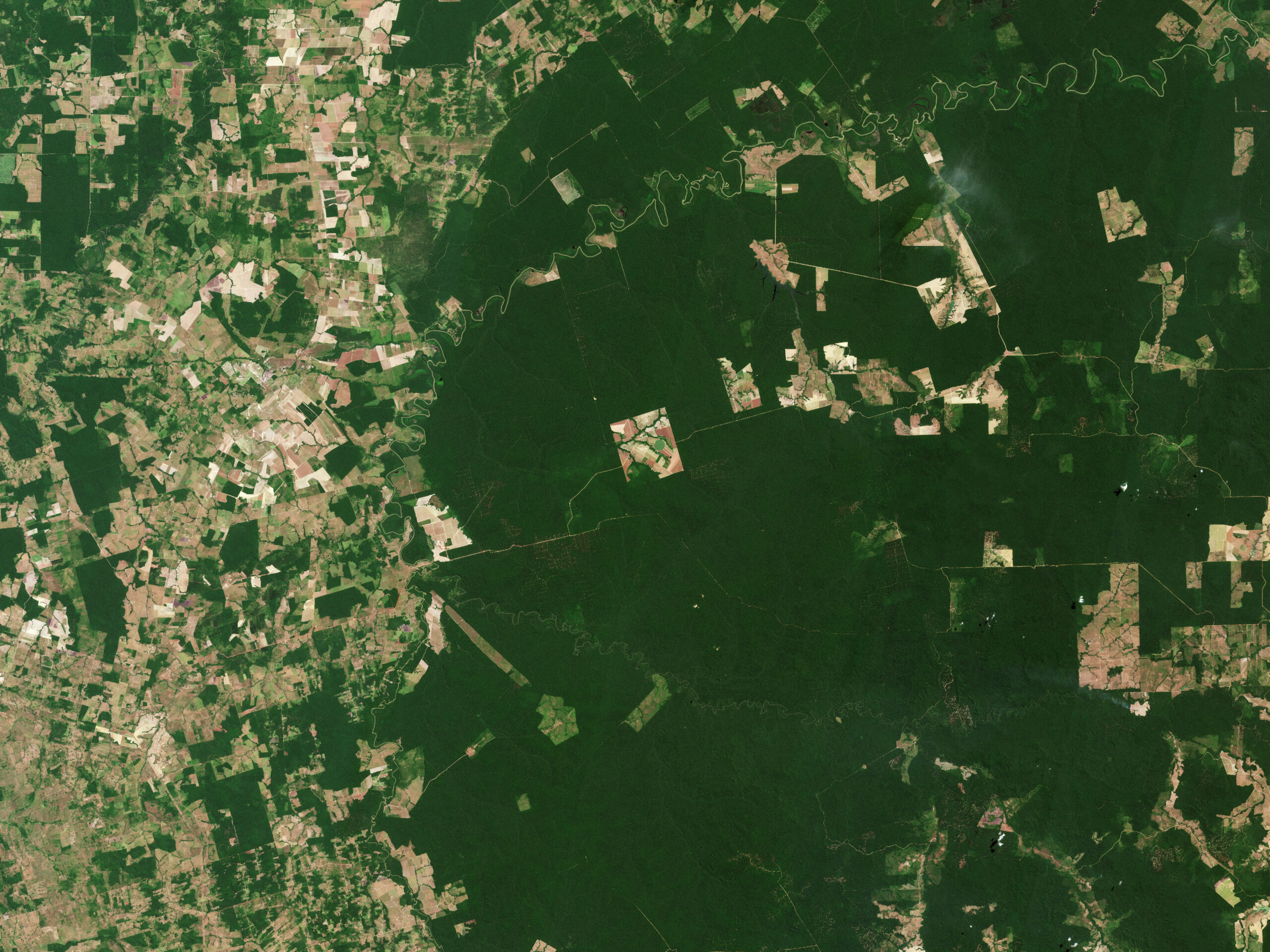
Earth Observation (EO) capabilities provide a powerful and scalable solution for mapping forest area extent. Unlike tree cover maps, which focus on land cover by identifying the presence of trees regardless of their context, forest area maps are inherently linked to land use. They distinguish between trees that are part of a forest ecosystem and those located outside. A critical requirement for forest area mapping is the adoption of a clear definition of forest, such as the one provided by the Food and Agriculture Organization (FAO).
FAO defines a forest as land spanning more than 0.5 hectares with trees higher than 5 meters and a canopy cover of more than 10 percent, or trees able to reach these thresholds in situ. However, individual countries may use their own forest definitions, which can vary based on national priorities, ecological conditions, and policy frameworks. These definitions may differ in terms of minimum area, canopy cover, tree height, or land use classification.
The process of mapping forest area extent relies on a tree cover map as a foundational input. The key challenge and value of forest area mapping lies in differentiating trees within forests (forest area) from trees outside forests (non-forest land uses). This distinction is essential for accurate reporting, policy implementation, and sustainable resource management, as it directly reflects how land is used and managed according to the applicable forest definition.
This process leverages a combination of high-resolution optical and radar data, such as Sentinel-2, Sentinel-1, and Landsat, to identify and delineate forest boundaries. However, because forest area mapping depends on land use classification, it requires additional ancillary information, including land tenure, management practices, and policy-specific criteria. This supplementary data ensures that trees within forests are distinguished from those in non-forest land uses, such as urban parks, orchards, or agroforestry systems.
The integration of Very High Resolution (VHR) imagery further enhances accuracy, particularly for validating forest boundaries and refining classifications in complex landscapes. Advanced analytical methods, including time-series analysis, artificial intelligence, and machine learning, enable the precise and scalable differentiation of forest areas according to the relevant definition.
By combining EO data with ancillary information, forest area mapping delivers actionable insights for sustainable forest management, policy compliance, and climate resilience, supporting both national and international reporting requirements.