Earthquakes
EO Capability Benefits
Earthquakes pose significant risks to populations, buildings, and critical infrastructure. Earth Observation (EO) data supports seismic hazard assessment by providing spatially consistent information on ground conditions, fault locations, and surface deformation, enabling more accurate estimations of where shaking is likely to be most severe. Understanding the intensity of ground shaking expected at a given location helps engineers, urban planners, and emergency managers design safer structures, prioritise retrofitting efforts, and prepare more effective disaster response plans.
EO Capability Description
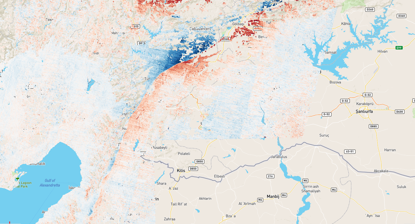
Seismic hazard assessment aims to estimate the likelihood and intensity of earthquake-related ground shaking at a specific location. A key output of such assessments is Peak Ground Acceleration (PGA), the maximum acceleration of the ground during an earthquake, typically expressed as a fraction of gravitational acceleration (g). PGA is widely used as an indicator of the potential for structural damage, as buildings and infrastructure are designed to withstand specific acceleration thresholds.
EO data contributes to seismic hazard assessment primarily through its ability to characterise the physical environment at scale, including terrain, land cover, surface geology, and fault mapping, which influences how seismic waves propagate and how the ground responds to shaking. Seismic hazard assessments can be implemented following a tiered approach, from broad screening to detailed site-specific analysis:
Basic: Use of existing global or regional seismic hazard maps, such as those produced under the Global Earthquake Model (GEM), combined with EO-derived land cover and terrain data to identify exposed assets and screen areas of potential concern. This approach is suited to initial risk overviews across large areas.
Intermediate: Application of multi-scenario earthquake simulations, in which different earthquake magnitudes, depths, and epicentral locations are tested across an area of interest. Historical earthquake catalogues, such as those maintained by the United States Geological Survey (USGS), are used to define realistic scenario parameters. PGA is estimated for each scenario and mapped spatially, allowing comparison across locations and infrastructure assets.
Advanced: Full probabilistic seismic hazard analysis incorporating regional climate and ground motion variability, site-specific soil amplification effects, and ensemble modelling approaches. At this level, results can be used to assess not only current risk but also how seismic hazard interacts with other vulnerabilities, such as building stock condition or population exposure, to estimate potential losses and inform long-term resilience planning.