Forest Characterisation
EO Capability Benefits
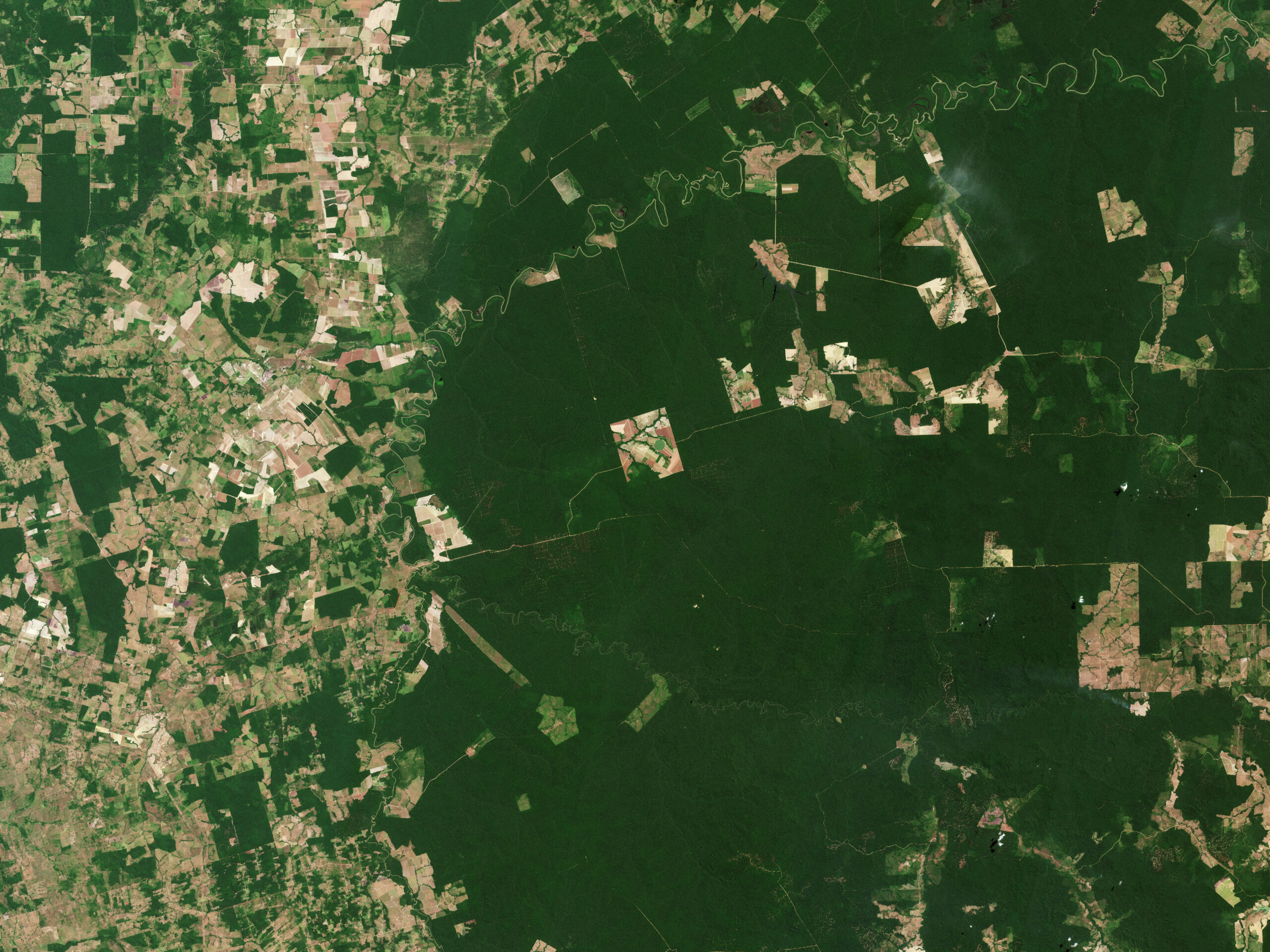
Forest characterisation using Earth Observation (EO) based data and technologies has become a widely used approach due to its ability to provide accurate and reliable key forest information with regards to ecosystem health, biodiversity and carbon storage over large-scales in a timely and cost-efficient manner. The generated insights yield crucial information when assessing deforestation, land use land cover change impacts, mapping habitats and estimating carbon stocks, as well as in support of sustainable forest management, conservation initiatives and climate change mitigation efforts.
EO Capability Description
Forest characterisation or classification involves assessing various aspects of forest ecosystems, such as location, structure, distribution, and species composition. The use of advanced Earth Observation (EO)-based data and methods allows for the coverage of extensive forest areas in a far more precise, scalable, and cost and time-efficient manner compared to traditional field sampling methods.
This approach utilises different sources of remote sensing-based information, including Optical, Synthetic Aperture Radar (SAR), LiDAR, and Hyperspectral sensors, to assess various aspects of forest ecosystems. Optical and hyperspectral sensors, for example, are used to capture species composition and ecosystem health, while SAR and LiDAR are often employed to generate insights into forest structure (e.g. height and density) and biomass.
Identifying the composition and structure of a forest is essential for understanding the ecosystem functions and services it provides, as well as its resilience to external stressors (e.g. climate change). Through time-series analysis, researchers can closely monitor trends in deforestation, degradation, and restoration.
The integration of artificial intelligence (AI) and machine-learning algorithms enhances the accuracy and scalability of forest classification and monitoring by efficiently combining multiple types of information, such as vegetation indices, canopy metrics, climate data, in-situ observations, and other ancillary insights.