

South Sudan Flooding Part 1 – Introduction
 ADD TO E-PORTFOLIO
 SUGGEST AN EDIT
ADD TO E-PORTFOLIO
SUGGEST AN EDIT
SUGGEST AN EDIT
ADD TO E-PORTFOLIO
SUGGEST AN EDIT
Training Resource Description
In recent years, flooding in South Sudan has become more severe, due to the growing impact of climate change in the region. The country currently faces major challenges in flood response due to limited monitoring systems and restricted access to essential data needed for effective mapping and management. Combined with widespread socioeconomic vulnerability, the population remains largely unprepared to cope with both the immediate impacts of flooding and its long-term consequences, resulting in greater destruction and loss of life. Building climate resilience has therefore become an urgent priority.
South Sudan suffered four consecutive years of excessive flooding between 2019 and 2022 that destroyed livelihoods and exacerbated food insecurity. In 2024 alone, over 1.4 million people were affected across 44 counties and more than 379,000 people were displaced by floodwaters . These floods disproportionately affect communities already facing socioeconomic vulnerabilities. An estimated 85% of South Sudan’s population engage in non-wage, rainfed agriculture, making them directly dependent on seasonal patterns of rainfall and water security.
To address these challenges and build resilience to future floods, the World Bank, in partnership with the GDA Climate Resilience activity, is supporting the South Sudan government in leveraging high-resolution Sentinel-1 radar imagery and rainfall data to track the extent, frequency, and duration of floods. This initiative is helping to create South Sudan’s first comprehensive flood hazard map and is implemented under the Regional Climate Resilience Programme for Eastern and Southern Africa and the World Bank’s South Sudan Climate Resilient Flood Management Project.
In the part 1 video, you will hear from government officials, World Bank specialists, trainees, and community members affected by floods. They share how South Sudan is taking critical steps to strengthen flood resilience and protect communities for the future.
Related resources and websites
- GDA Story: Flooding Management in South Sudan – Read more about this Case Study on the GDA website
- GDA Impact Sphere: Tackling flood risks in South Sudan – Explore this Case Study further on the Impact Sphere
- Water Security in South Sudan – A short video from the World Bank
Featured Imagery
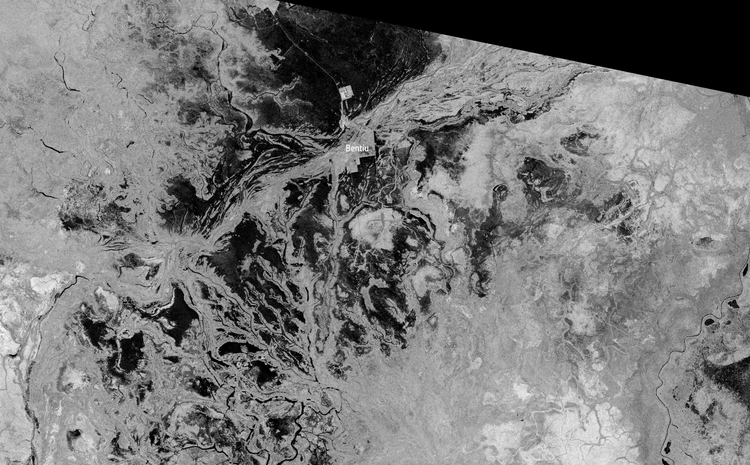
This Sentinel-1 SAR image from September 1st, 2024 reveals major flooding around Bentiu, South Sudan. Dark areas south and southwest of town mark widespread surface water along the White Nile floodplain, highlighting seasonal inundation.
Source: Contains modified Copernicus Sentinel data [2024], processed by EO Browser