

Forest Monitoring Part 2 – Introduction
 ADD TO E-PORTFOLIO
 SUGGEST AN EDIT
ADD TO E-PORTFOLIO
SUGGEST AN EDIT
SUGGEST AN EDIT
ADD TO E-PORTFOLIO
SUGGEST AN EDIT
Training Resource Description
According to Global Forest Watch, between 2001 and 2025, forests in Mexico had a net carbon sink of -130 million tonnes of carbon dioxide equivalent per year. This makes them important to the country’s ambitious climate targets for both mitigation and adaption under the Paris Agreement. Forests absorb large amounts of carbon, helping balance emissions from other sectors, while also supporting livelihoods and poverty reduction.
Monitoring deforestation, forest degradation and restoration is therefore essential for tracking and supporting progress towards Mexico’s targets.
The collaboration between ESA GDA, the World Bank and CONAFOR, is introducing new technology to provide more reliable, accurate and timely information on forest ecosystems, including threats from pests and diseases. This improved monitoring helps address the drivers of deforestation more quickly.
In this video, you’ll hear how new satellite‑based monitoring tools are being used in Durango to track deforestation, forest degradation, and restoration, improve understanding of forest conditions, and support more effective forest management aligned with Mexico’s climate goals.
Related resources and websites
- GDA Story: Satellite Data Supports Forest Inventories in Mexico – Read more about this case study on the GDA website
Featured Imagery
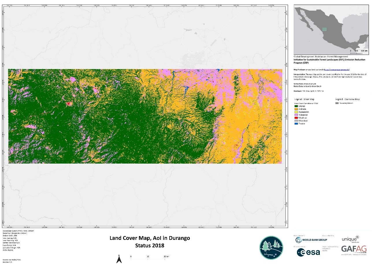
This map shows the land‑cover distribution inthe study area in Durango, Mexico, for the year 2018. Different colours represent distinct land‑cover types, including forest, shrubland, grassland, cropland, built‑up areas, bare land, and water.
Source: GDA AID Forest Management Consortium
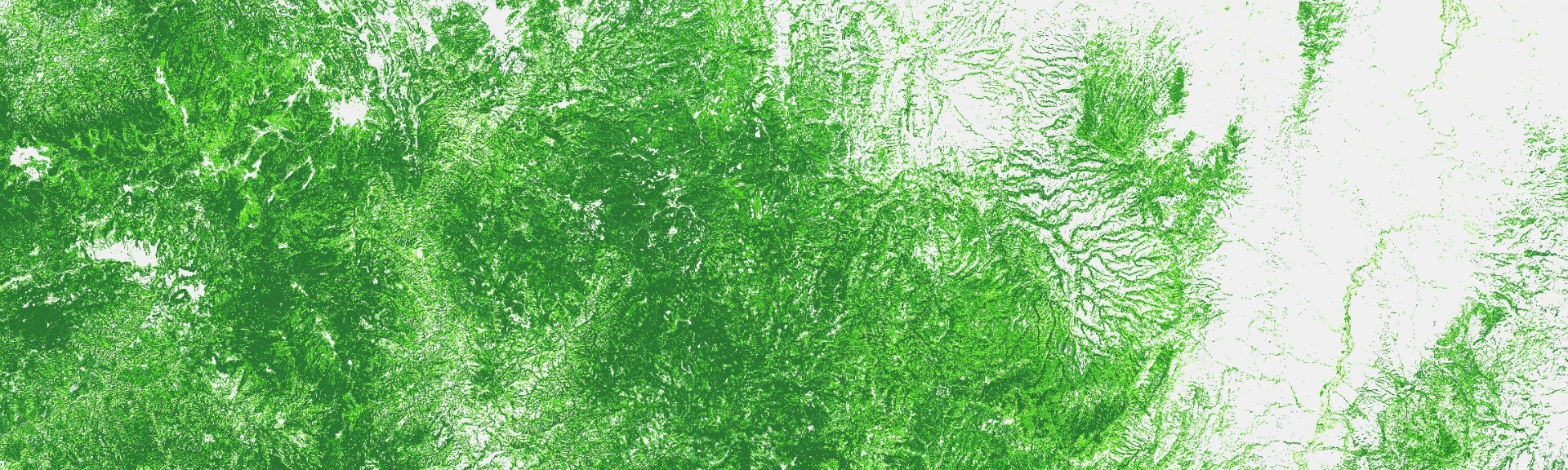
Tree cover density map in the project area in Durango, Mexico. areas shaded in green represent zones with high tree‑cover density, and white areas indicate low or no tree cover.
Source: GDA AID Forest Management Consortium
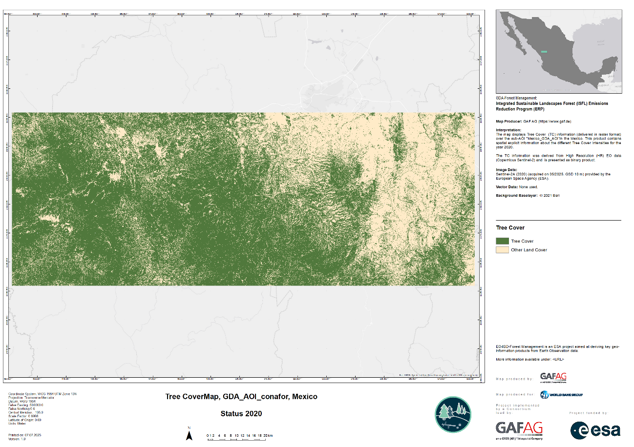
This map shows the tree‑cover distribution within the study area in Durango, Mexico in 2020. The green areas show tree cover and the beige represents other land cover types.
Source: GDA AID Forest Management Consortium