

Tree & Mangrove Mapping Part 2 – Introduction
 ADD TO E-PORTFOLIO
 SUGGEST AN EDIT
ADD TO E-PORTFOLIO
SUGGEST AN EDIT
SUGGEST AN EDIT
ADD TO E-PORTFOLIO
SUGGEST AN EDIT
Training Resource Description
Mangroves act as a natural barrier against storm surges, sea level rise and coastal erosion, thus protecting them and maintaining them is crucial, as well as the potential to expand them as a natural coastal greenbelt. Effective monitoring is therefore vital to understanding changes in mangrove extent and condition.However field-based monitoring is limited. The use of Earth Observation (EO) therefore supports more effective monitoring and management.
The tools developed by the GDA Forest consortium were designed to improve forest management in Bangladesh. Several baseline EO products using freely available Copernicus Sentinel data at 10 m spatial resolution were developed. They include:
- Mangrove extent mapping – using Sentinel-2 imagery to map mangroves across a large 52,000 km² coastal area.
- Tree cover mapping – identifying tree-covered areas across a 13,586 km² area spanning Rangamati, Chittagong, Cox’s Bazar and Bandarban in the Chittagong Hill Tracts.
- Tree cover density – provides proportional canopy cover in 10% classes
- Tree cover disturbance monitoring – uses bi-weekly Sentinel-1 radar observations, to capture disturbance events over time, including in the Kassalong Reserved Forest.
In this video, you will hear how Earth Observation tools are enabling near real-time detection of forest loss, supporting forest restoration, and improving decision-making to better protect Bangladesh’s forests.
Related resources and websites
- GDA Story: Strengthening coastal resilience and forest management in Bangladesh with EO – Read more about this story on the GDA website
Featured Imagery
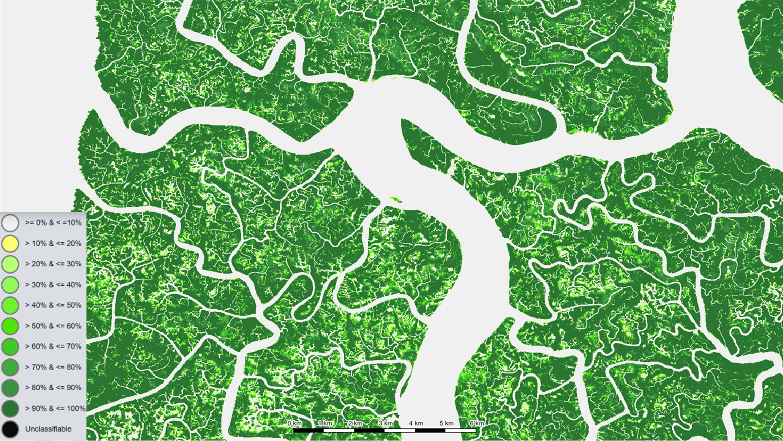
This map shows tree cover density in the Sundarbans, with green shades representing different levels of tree cover. Darker greens indicate higher tree cover density, while lighter shades indicate lower density. White areas represent rivers, waterways, and other non-forest areas.
Source: GAF AG
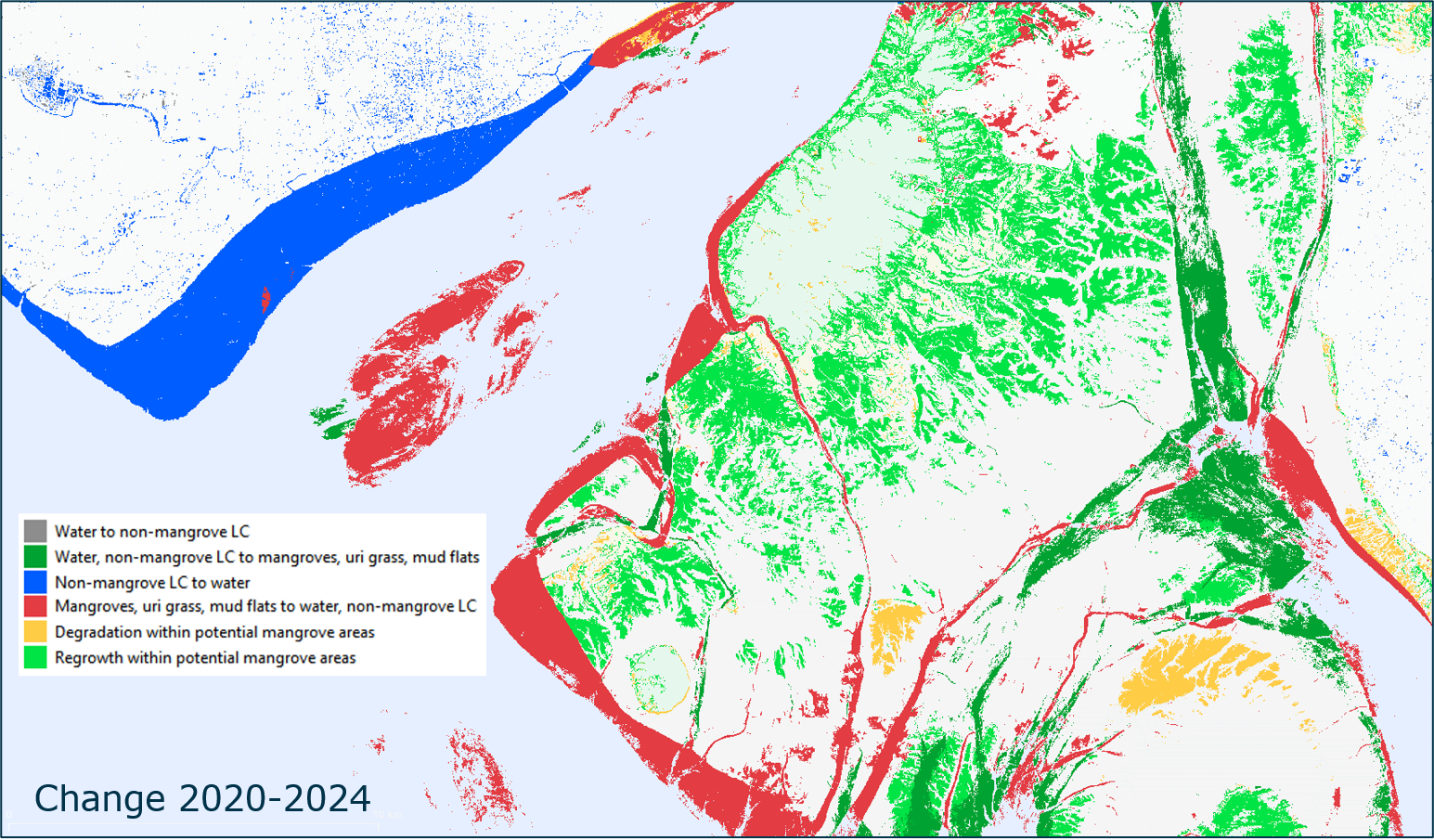
This map illustrates mangrove vegetation change in a coastal mangrove region of Bangladesh between 2020 and 2024.
Source: GAF AG