

Tree & Mangrove Mapping Part 1 – Introduction
 ADD TO E-PORTFOLIO
 SUGGEST AN EDIT
ADD TO E-PORTFOLIO
SUGGEST AN EDIT
SUGGEST AN EDIT
ADD TO E-PORTFOLIO
SUGGEST AN EDIT
Training Resource Description
The Sundarbans is the largest continuous mangrove forest in the world, spanning 140,000 ha, it lies on the delta of the Ganges, Brahmaputra and Meghna rivers in the Bay of Bengal. Over 3.5million people depend on the Sundarbans, which also acts as a coastal defence against extreme weather events, sea level rise and erosion. However, the Sundarbans are increasingly threatened by climate change, rising sea levels and human activities.
Another area under threat in Bangladesh is the Chittagong Hill Tracts, home to tropical and subtropical evergreen forests, and currently the area most susceptible to deforestation in the country, including in protected areas such as the Matamuhuri and Rankhiang Reserved Forests.
In response to these challenges, the GDA Forest consortium is supporting the World Bank, in the preparation of a multisectoral coastal resilience programme in Bangladesh, designed to help safeguard vulnerable coastal communities, protect natural capital, and improve sustainable livelihoods, working together with the Bangladesh Forest Department. With the aim to use high-resolution Earth Observation data to monitor mangroves and near real-time forest degradation and deforestation systems.
In this video you will hear how satellite-based Earth Observation technology is helping Bangladesh monitor its forests, protect the Sundarbans, and combat deforestation through international collaboration and local capacity building.
Related resources and websites
- GDA Story: Strengthening coastal resilience and forest management in Bangladesh with EO – Read more about this story on the GDA website
Featured Imagery
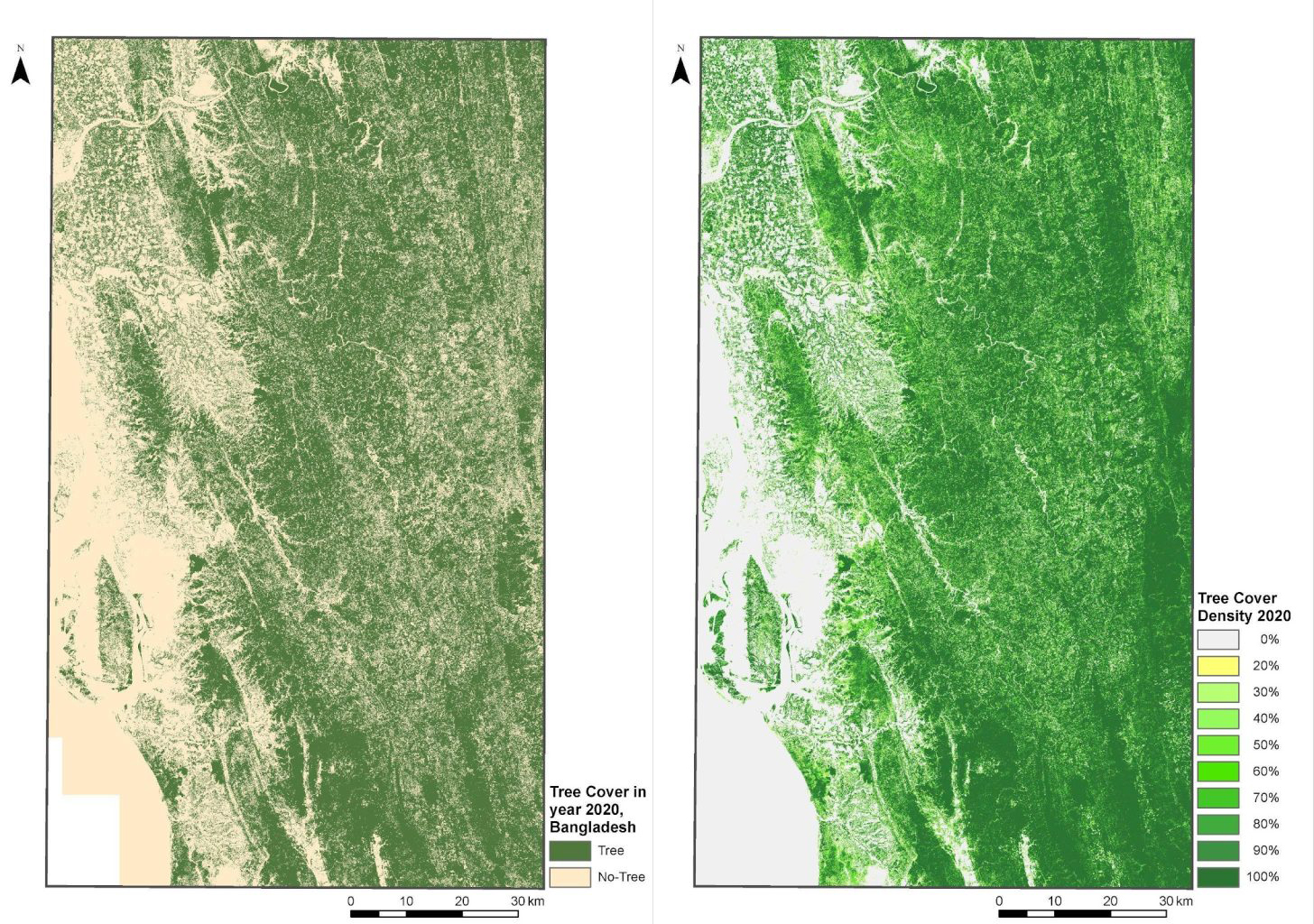
Tree Cover Map (Left) and Tree Cover Density Map (Right) for 2020 in Bangladesh
Source: GAF AG
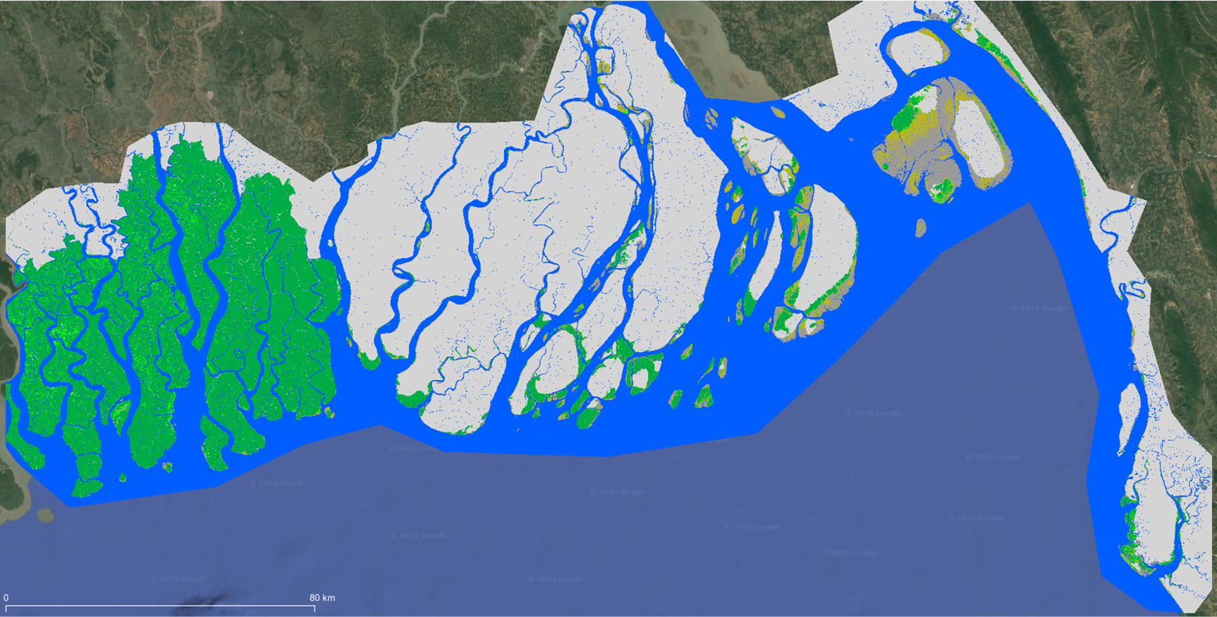
Mangrove Vegetation Extent (MVE) Map for coastal Bangladesh, 2020
Source: GAF AG
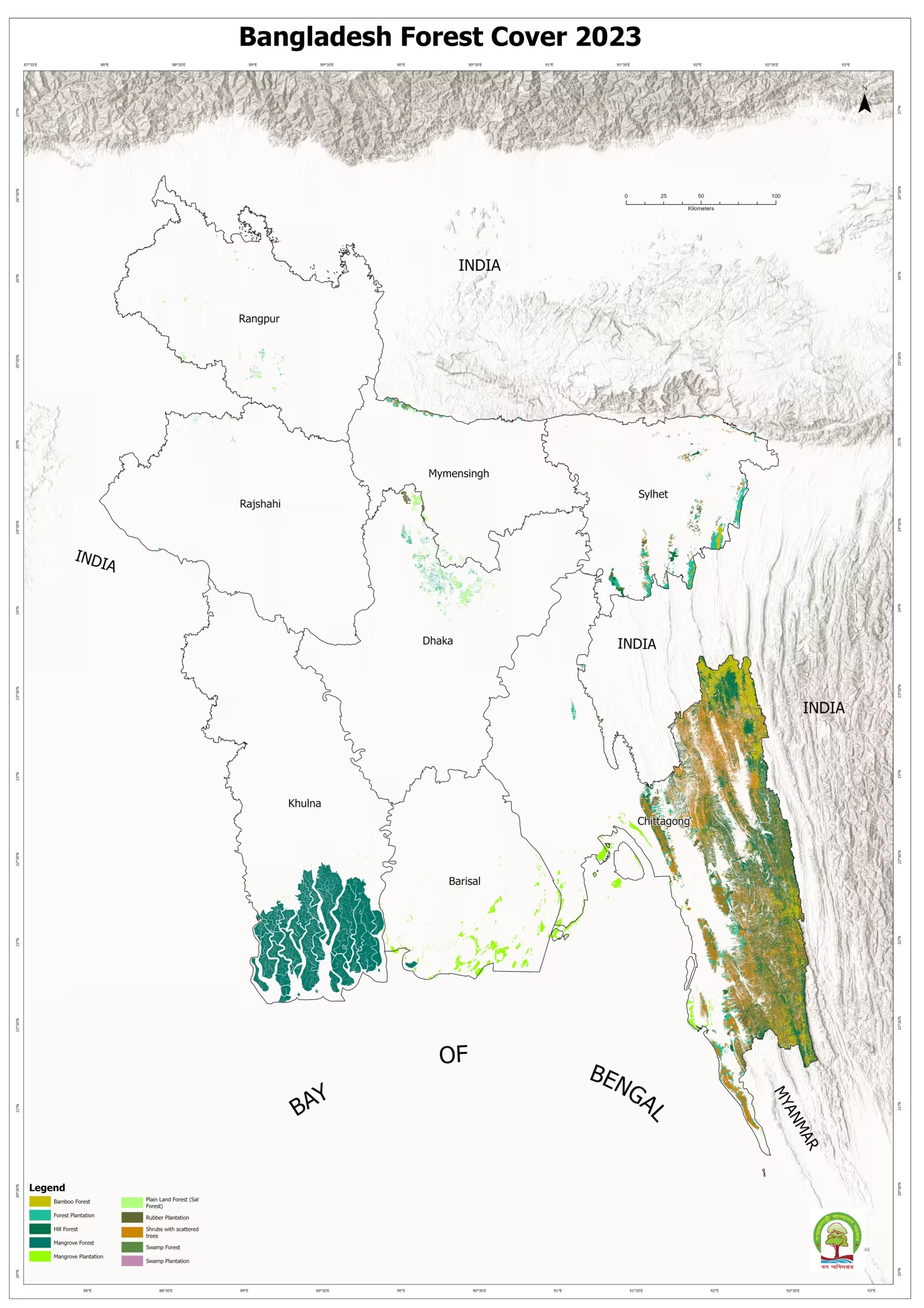
This map shows the areas of forest cover and type across Bangladesh
Source: Bangladesh Forest Department

Normalized Difference Vegetation Index (NDVI) in an area of the Chittagong Hill Tracts, Bangladesh, March 2026
Source: Contains modified Copernicus Sentinel data 2026, processed with Copernicus Browser
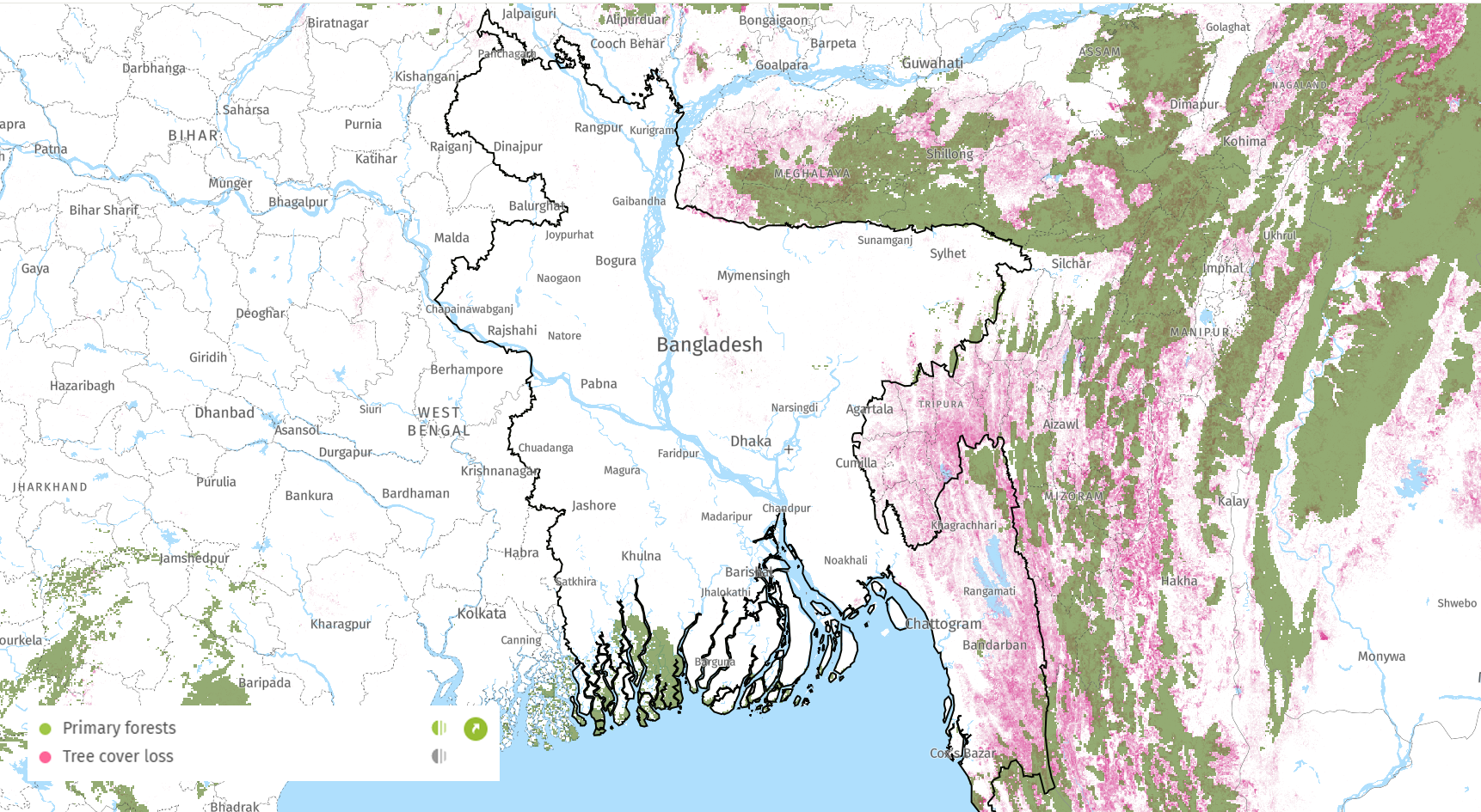
Areas of tree cover lose (green) in Bangladesh
Source: Global Forest Watch