Plastic Drift
EO Capability Benefits
Marine litter, primarily composed of plastics, poses significant ecological and health risks. Remote sensing offers a promising approach for monitoring marine debris on the open seas and in coastal regions. By analyzing satellite imagery and ocean current models, researchers can identify the sources of plastic pollution and how it spreads across the ocean, thus helping to support both clean-up campaigns as well as at-source interventions.
EO Capability Description
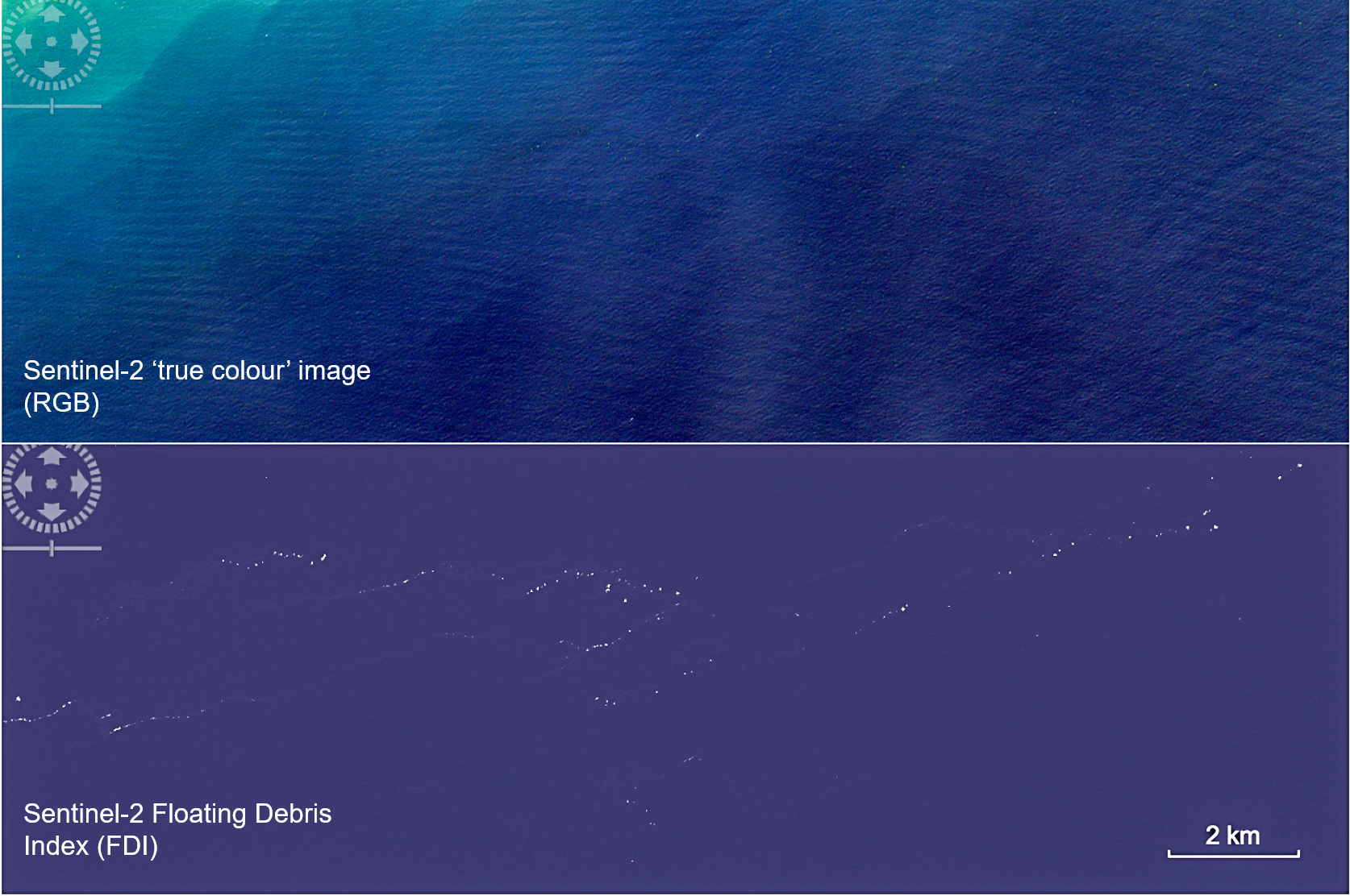
Detecting floating plastic from space remains highly challenging. Due to the large areas to be monitored, commercial Very High Resolution (VHR) imagery is seldom an option. Instead, free and open High Resolution (HR) optical imagery from Sentinel-2 has been annotated to train AI models resulting in a probability map at the pixel level. While Sentinel-2 can be augmented with commercial Very High Resolution (VHR) optical imagery, challenges remain in distinguishing between man-made and natural debris. HR optical is also combined with hyperspectral imagery to assist in differentiating the spectral signatures of various types of debris.
A recent experimental study in Nature suggests that combining active microwave scatterometry with passive optical sensors in the short wave Infrared (SWIR) and near infrared (NIR) spectrum could allow for more accurate EO-based plastic drift monitoring under certain conditions in the future. Both wave patterns, plastic type and plastic concentrations were shown to affect detection accuracy.