Ground Displacement
EO Capability Benefits
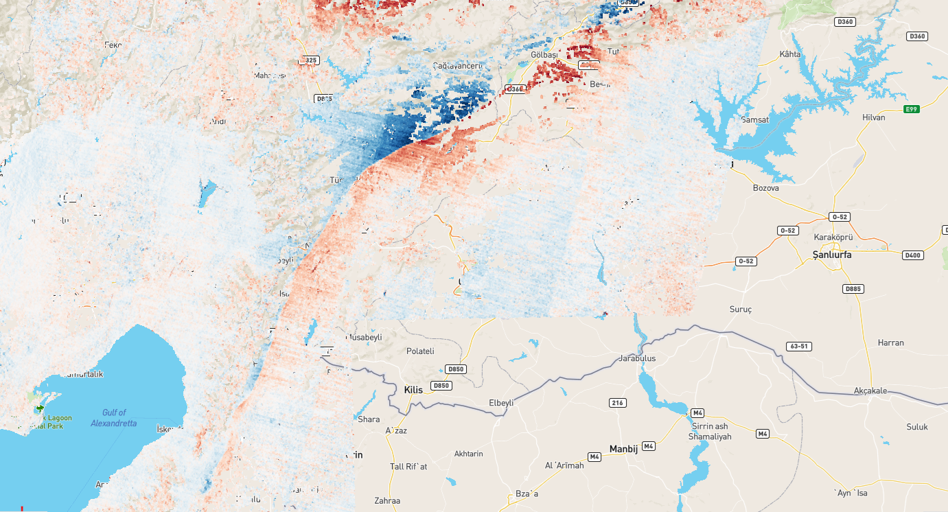
Even relatively modest instances of ground displacement can weaken the structural integrity of buildings and infrastructure which, in severe cases, poses an immediate threat to life. EO data allows for the monitoring of ground displacement at millimeter accuracy, which is essential for adopting effective mitigation strategies.
EO Capability Description
Ground displacement refers to the movement of the Earth’s surface from its original position. This can occur in both the vertical (subsidence and uplift) and horizontal direction. Ground displacement can be triggered by tectonic activity, landslides and slope instability, soil consolidation, but also human activity such as urban development leading to increased load, the extraction of groundwater, gas or oil, or mining activity. EO data can support the tracking of ground displacement using radar images provided by missions such as Sentinel-1 or TerraSAR-X. The remote sensing technique known as “radar interferometry” combines two or more radar images from the same orbital geometry over the same area to detect changes occurring between acquisitions. Interferometry allows for the monitoring of even slight ground movement—down to a few millimeters—across large areas. These millimetrer-scale measurements of ground motion enable, among others, the mapping of subsidence and landslides, as well as areas affected by seismic and tectonic activity.
Indicative Cost Range Details
For some regions such as Europe, ground displacement data is available free of charge (in this case through the European Ground Motion Service).