
Using EO to Understand the Link Between Water Scarcity and Conflict in Iraq
The EO4SD FCS collaboration with the UNDPPA enhanced the use of satellite-based environmental data to support early warning systems and conflict prevention strategies in fragile contexts, with a focus on water scarcity in Iraq.
Description
The ESA Earth Observation for Sustainable Development (EO4SD) Fragility, Conflict and Security (FCS) activity partnered with the United Nations Department of Political and Peacebuilding Affairs (UNDPPA) to support its efforts in understanding the relationship between water scarcity and conflict. This collaboration focused on enhancing the UNDPPA’s ability to identify environmental stressors that may contribute to instability, particularly in fragile and conflict-affected settings.
As part of its broader investigation into the water-conflict nexus, the UNDPPA had begun compiling an extensive database of water-related information. With this resource, the department aimed to explore new analytical approaches for understanding how variations in water availability may influence or exacerbate conflict dynamics. The EO4SD FCS consortium was brought in to determine what novel Earth Observation (EO) data could be integrated into this database to strengthen the analysis.
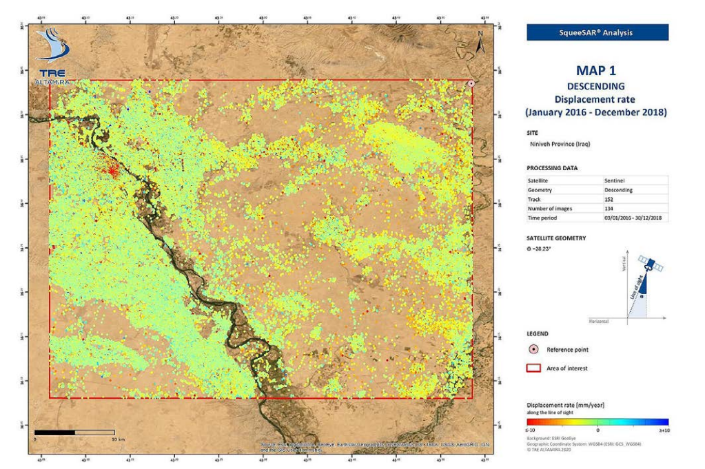
The initial focus of the project was Iraq. The consortium proposed incorporating water body elevation data derived from open-source satellite altimetry and ground elevation data obtained through InSAR (Interferometric Synthetic Aperture Radar). Two demonstration services were carried out: one provided long-term time series data on the elevation of lakes and rivers across the country, while the other focused on a 40 km by 40 km area near Mosul, using InSAR data to assess ground deformation potentially linked to water extraction or infrastructure pressures.
These EO-based insights offered significant added value to the UNDPPA’s monitoring framework, helping to contextualize water scarcity within broader patterns of fragility. By layering geospatial and hydrological data with political analysis, the partnership is contributing to more informed peacebuilding and conflict prevention efforts.
Related Use Case