Leveraging EO Data for Deforestation-Free Value Chains in Guyana
The GDA Agriculture Consortium collaborated with the World Bank on the Guyana World Bank-funded Sustainable Agriculture and Forestry Policy Assessment (SAFPA) project.
Description
The GDA Agriculture Consortium collaborated with the World Bank on the Guyana World Bank-funded Sustainable Agriculture and Forestry Policy Assessment (SAFPA) project. The project supports policy reforms aimed at promoting sustainable land use, enhancing agricultural productivity, and conserving forest ecosystems, with a focus on integrating climate resilience, biodiversity protection, and sustainable resource management.
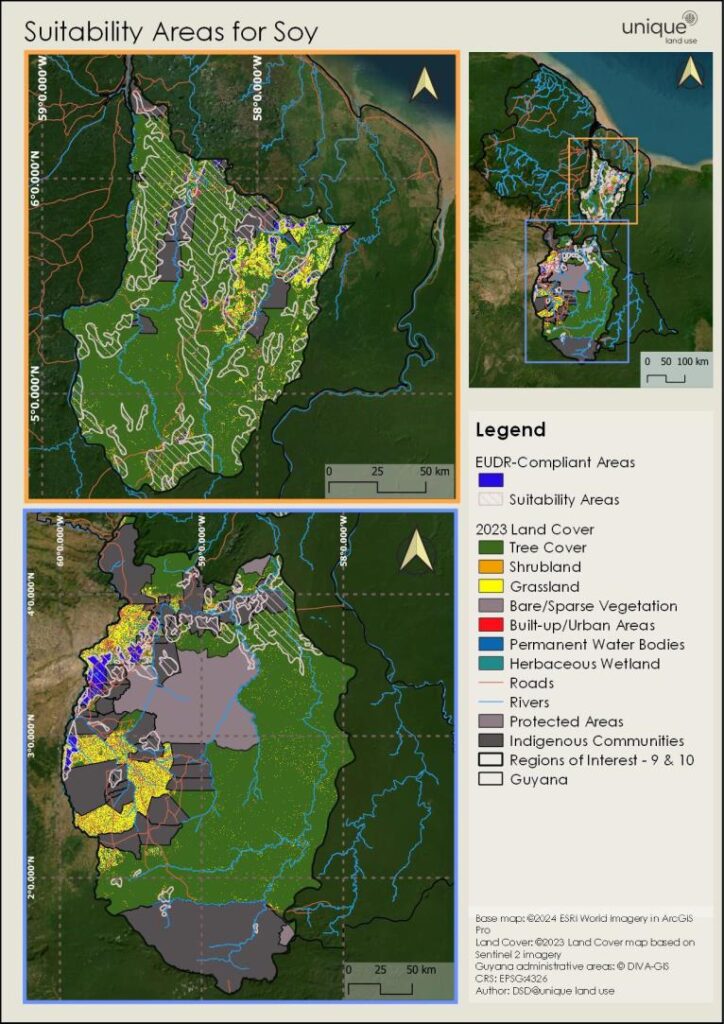
A central goal was to develop a methodology leveraging Earth Observation (EO) data and geospatial analysis to guide sustainable land management and enable deforestation-free agricultural value chains. During the project, several EO products were developed, including:
- Land cover and forest loss maps
- Agricultural suitability maps for key commodities (soy, corn, rice, peanuts, poultry)
- Predictive urban growth and market analyses for target value chains in Regions 9 and 10, and the Georgetown–Paramaribo corridor
These tools supported investment decisions aligned with the European Union Deforestation Regulation (EUDR) and
were highly valued by World Bank stakeholders for improving risk management, land-use monitoring, and supply chain optimization. Feedback emphasized the tools’ usefulness for precision agriculture, biodiversity safeguards, and cost-effective, scalable land assessment.