

Improving Livestock Farming Part 2 – Introduction
 ADD TO E-PORTFOLIO
 SUGGEST AN EDIT
ADD TO E-PORTFOLIO
SUGGEST AN EDIT
SUGGEST AN EDIT
ADD TO E-PORTFOLIO
SUGGEST AN EDIT
Training Resource Description
Agriculture accounts for around 70% of Paraguay’s exports, and the country is a significant global exporter of commodities such as soybeans and beef, making the sector extremely important. The country is accustomed to using satellite data, and conversations with partners highlight just how valuable this information has become. However, satellite data still needs to be faster, more agile, and consolidated in one place so they can analyse risks more effectively. This is now a possibility due to the joint efforts of ESA, the World Bank and the Spanish Fund for Latin America and the Caribbean working together with FECOPROD.
Satellite data provides far more than imagery, it can be used to estimate data such as evapotranspiration, across large and otherwise inaccessible areas where monitoring on the ground is not possible. This kind of information is critical for agriculture, as it enables more precise water management and irrigation scheduling, and helps farmers adapt to extreme drought conditions.
Related resources and websites
- GDA Story: Improving Livestock Farming in Paraguay with EO – Read more about this story on the GDA website
- FEDCOPROD – The Production Cooperative Federation (FECOPROD) website
Featured Imagery

NPP (Net Primary Production) for the Gran Chaco region, Paraguay.
Source: Modified Copernicus Data, 2026, processed in Copernicus Browser.
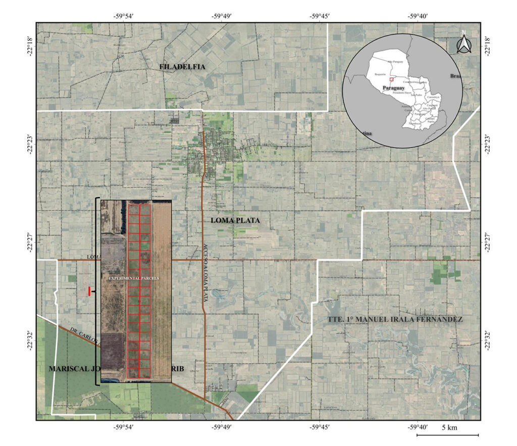
This map shows the Area of Interest (AoI) in Paraguay where the study took place.
Source: GDA AID Agriculture Consortium
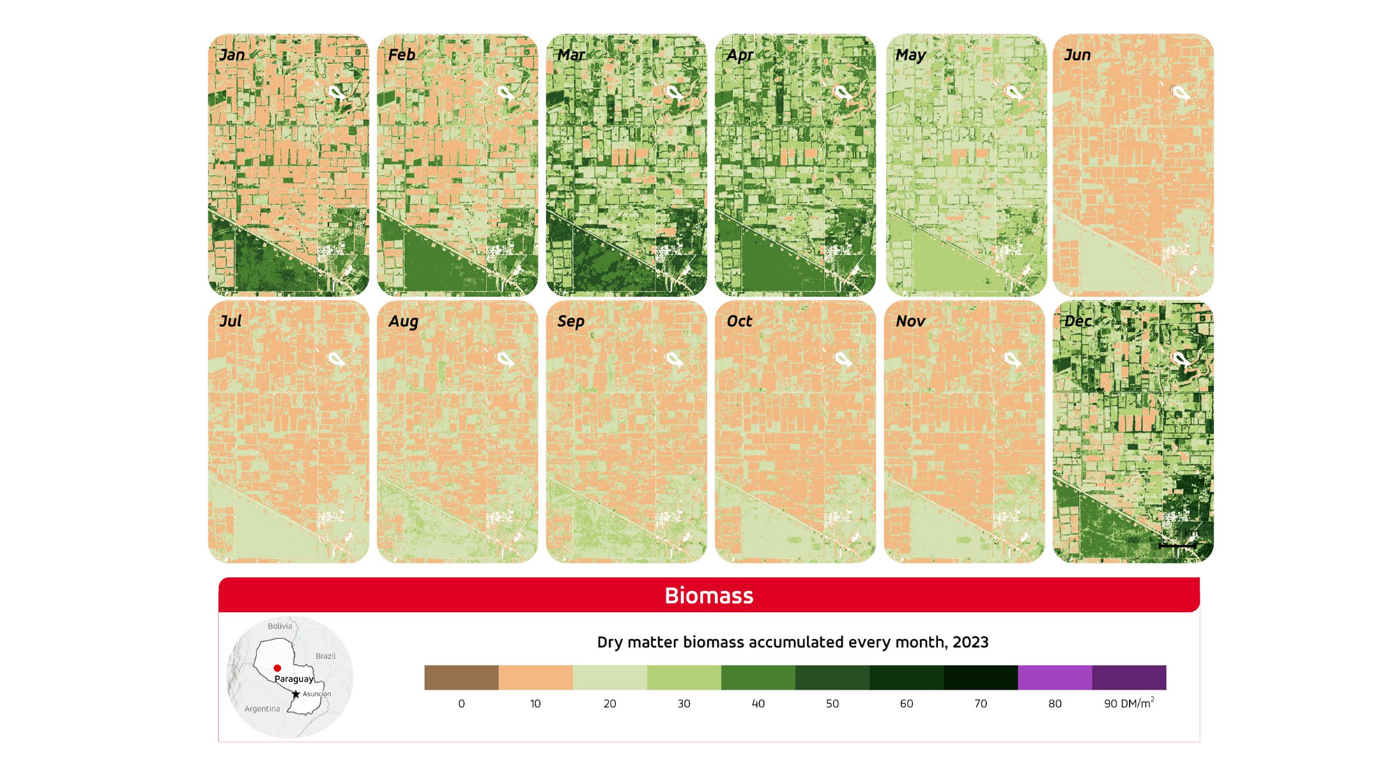
Dry Matter Biomass levels each month of 2023, for the study area in Paraguay.
Source: GDA AID Agriculture Consortium
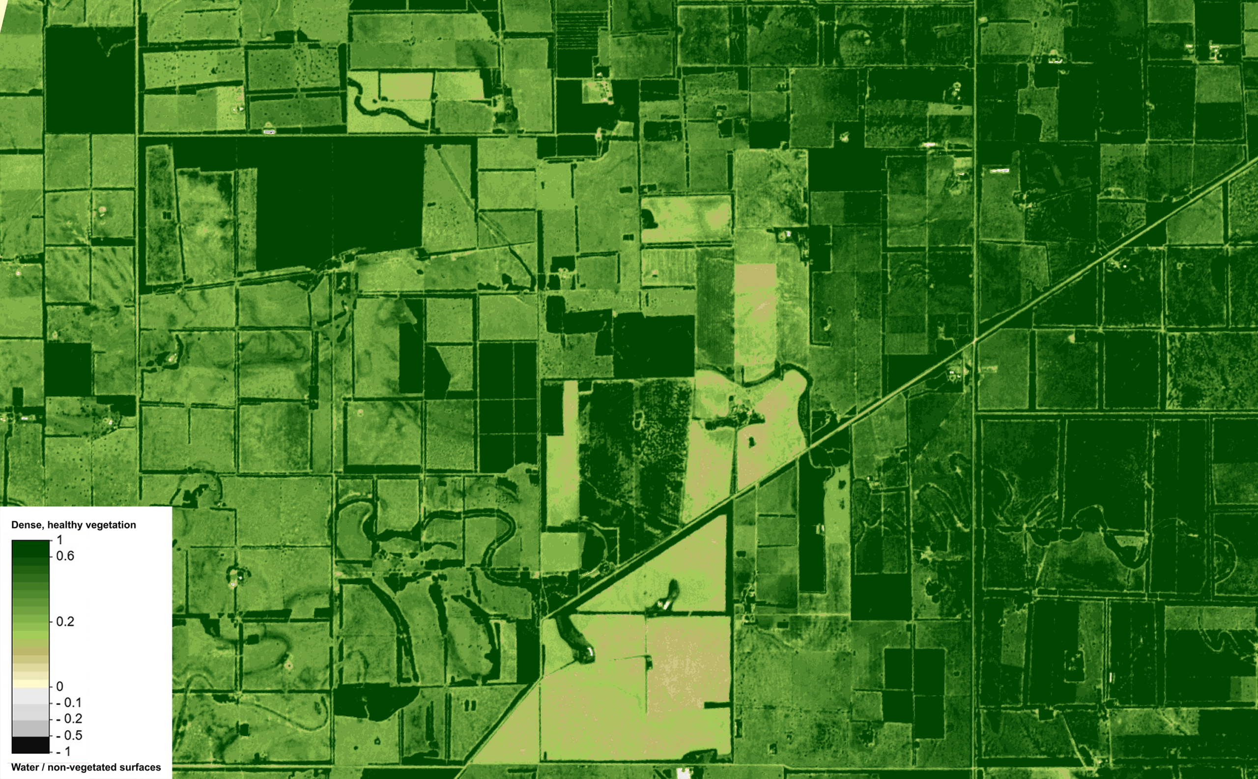
This map shows vegetation health across an area of agricultural fields just south of Loma Plata, Paraguay, derived from Sentinel‑2 NDVI. Darker greens represent areas of dense, healthy vegetation, lighter greens reflect moderate or low growth.
Source: Modified Copernicus Data, 2026, processed in Copernicus Browser.
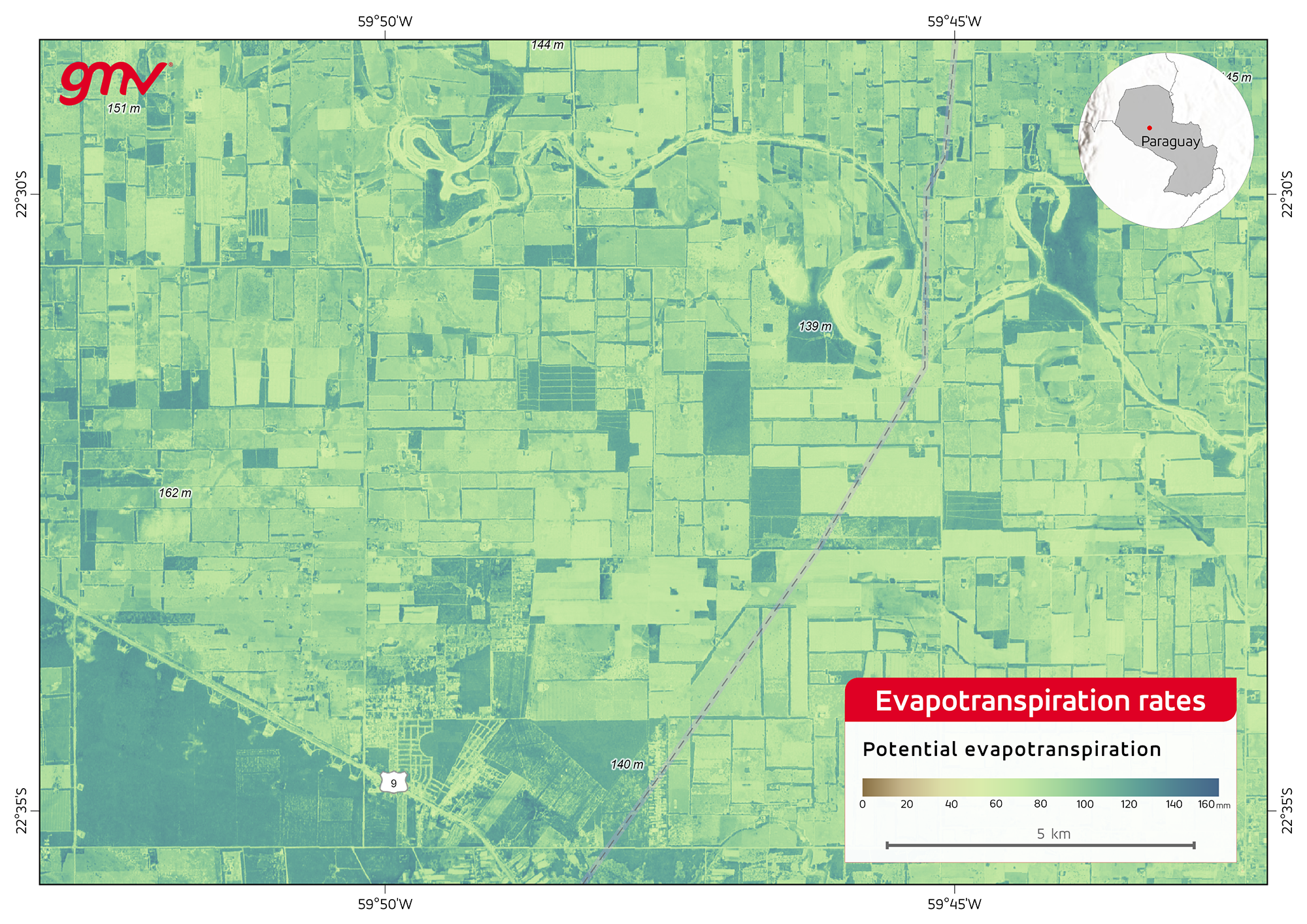
Potential evapotranspiration levels in the study area in Paraguay
Source: GDA AID Agriculture Consortium