

Improving Livestock Farming Part 1 – Introduction
 ADD TO E-PORTFOLIO
 SUGGEST AN EDIT
ADD TO E-PORTFOLIO
SUGGEST AN EDIT
SUGGEST AN EDIT
ADD TO E-PORTFOLIO
SUGGEST AN EDIT
Training Resource Description
Paraguay’s livestock sector is central to the country’s economy, supporting over 300,000 jobs and covering 16 million hectares of pasture. But climate pressures, environmental degradation, and three consecutive years of La Niña have strained productivity and natural resources.
To help farmers adapt, the World Bank and GMV, as part of ESA GDA AID Agriculture, are working with FECOPROD (Production Cooperative Federation), a cooperative federation that represents and supports the interests of agricultural producers, to integrate Earth Observation and local weather data into digital tools that improve decision‑making, monitor pasture conditions, and support more sustainable livestock practices.
By combining satellite‑derived vegetation and biomass indicators with on‑farm records, farmers can optimise grazing, monitor water availability, prevent overgrazing, and improve feed efficiency. EO‑based pasture assessments help ensure livestock receive adequate nutrition, while climate and weather data enable producers to anticipate extreme conditions and adapt their practices.
This video follows livestock producers and technical experts discussing shifting weather patterns, the importance of preserving trees and soil moisture, and the growing value of regenerative grazing. It also highlights how Earth Observation data, is helping farmers monitor biomass, understand pasture conditions, and make more informed decisions.
Paraguay is building a stronger, more efficient, and more sustainable agricultural future by combining satellite data with local systems and making these tools available across the country. This will help producers, cooperatives and the country make better decisions.
Related resources and websites
- GDA Story: Improving Livestock Farming in Paraguay with EO – Read more about this story on the GDA website
- FEDCOPROD – The Production Cooperative Federation (FECOPROD) website
Featured Imagery
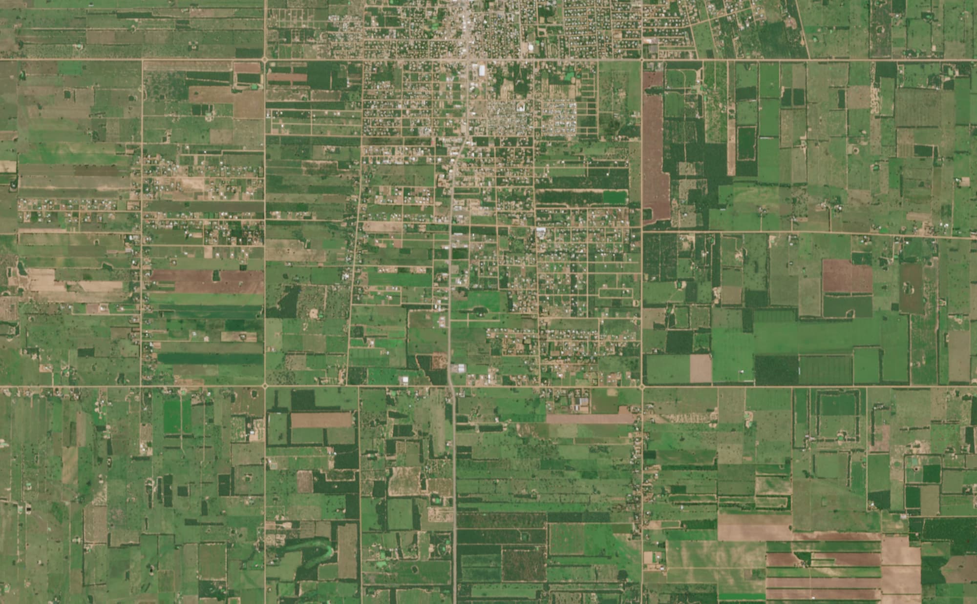
Sentinel-2 image of Loma Plata, Paraguay.
Source: Modified Copernicus Data, 2026, processed in Copernicus Browser.
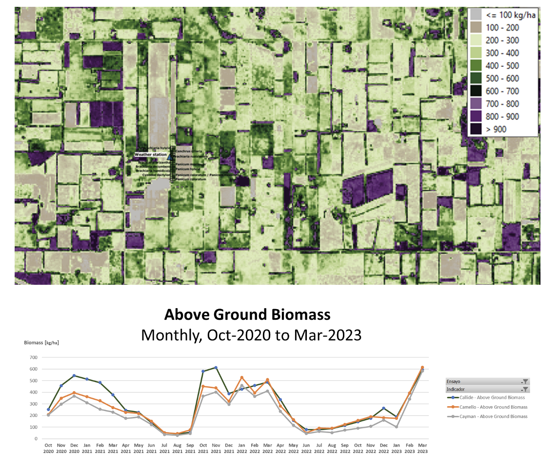
Map and chart showing biomass estimates in the study area (2020 – 2023).
Source: GDA AID Agriculture Consortium.

This image shows soil moisture conditions derived from Sentinel‑1 radar data across an area of agriculture fields south of Loma Plata, Paraguay. The colour scale highlights variations in moisture levels: dark blue indicates high soil moisture (>0.4), medium blue shows moderate moisture (≤0.4), light blue marks low moisture (≤0.2), and white areas represent dry conditions (≤0).
Source: Modified Copernicus Data, 2026, processed in Copernicus Browser.
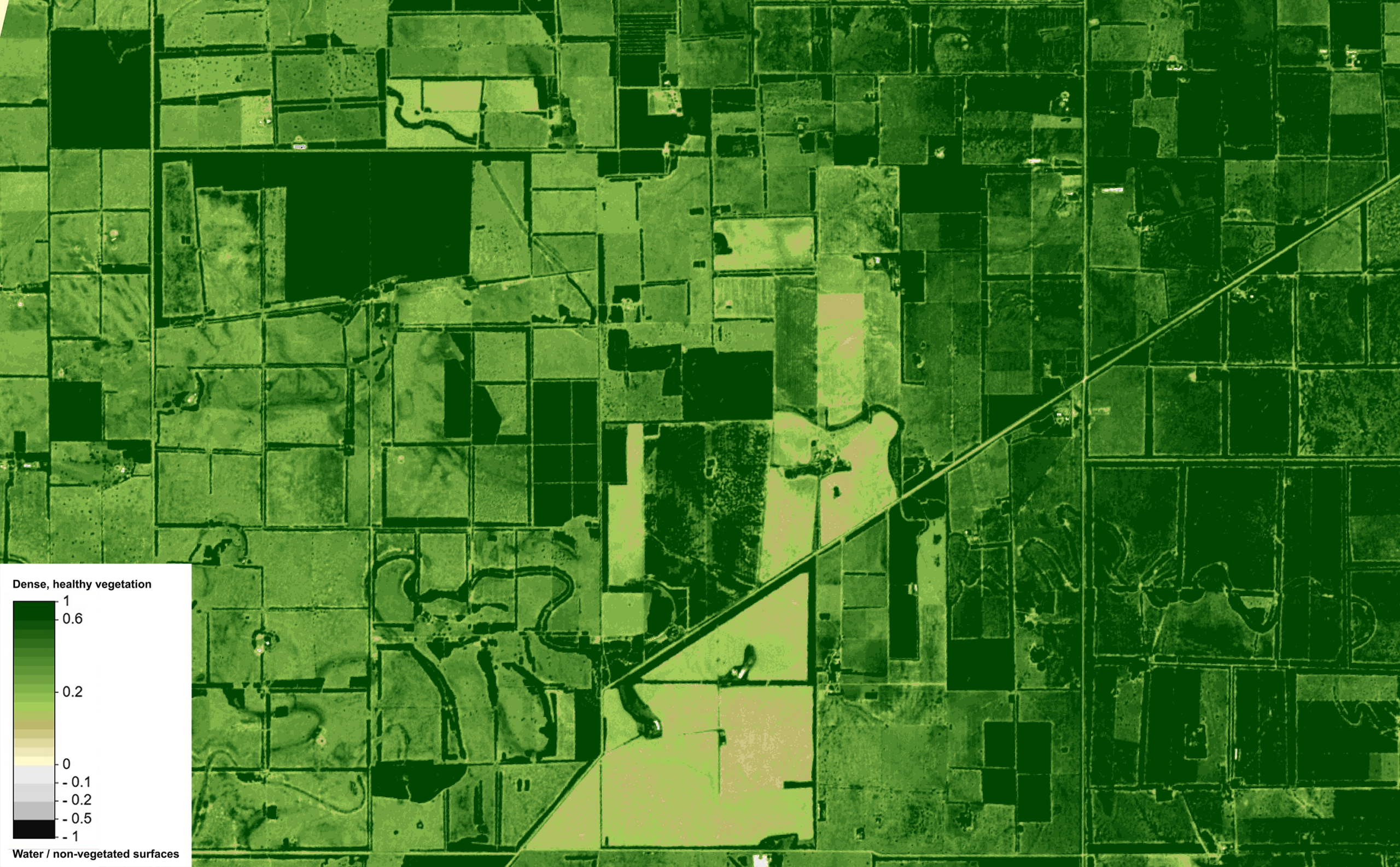
This map shows vegetation health across an area of agricultural fields just south of Loma Plata, Paraguay, derived from Sentinel‑2 NDVI. Darker greens represent areas of dense, healthy vegetation, lighter greens reflect moderate or low growth.
Source: Modified Copernicus Data, 2026, processed in Copernicus Browser.